Archive for the ‘landmark’ tag
The Village Tavern, 214 Berryhill Road: Feb 2010 4 comments
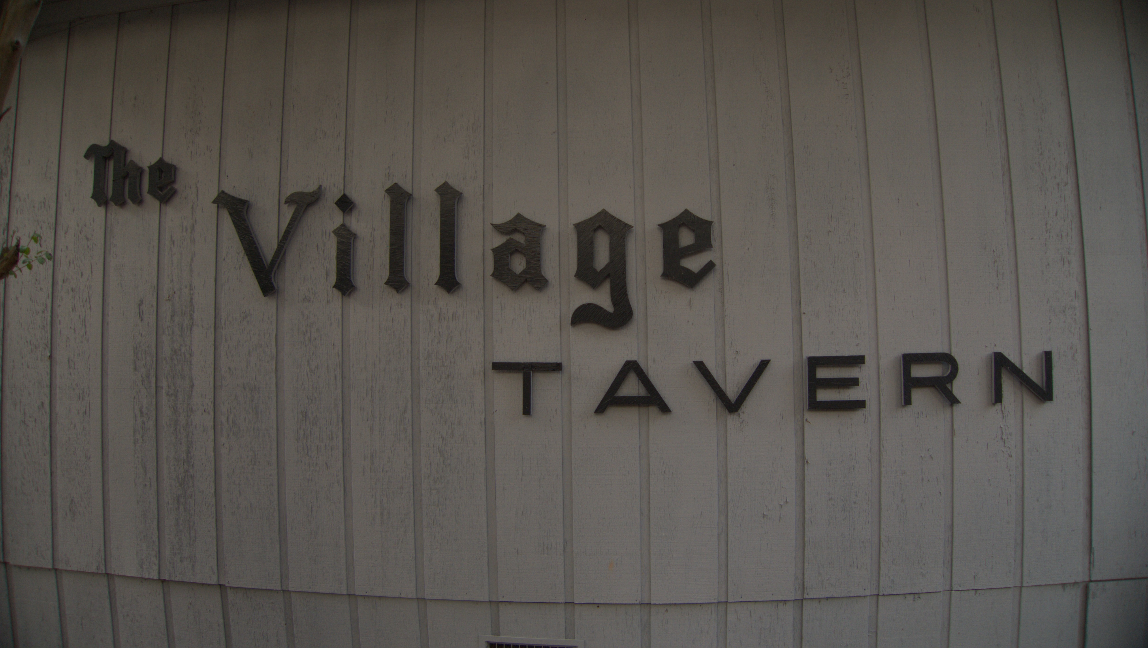
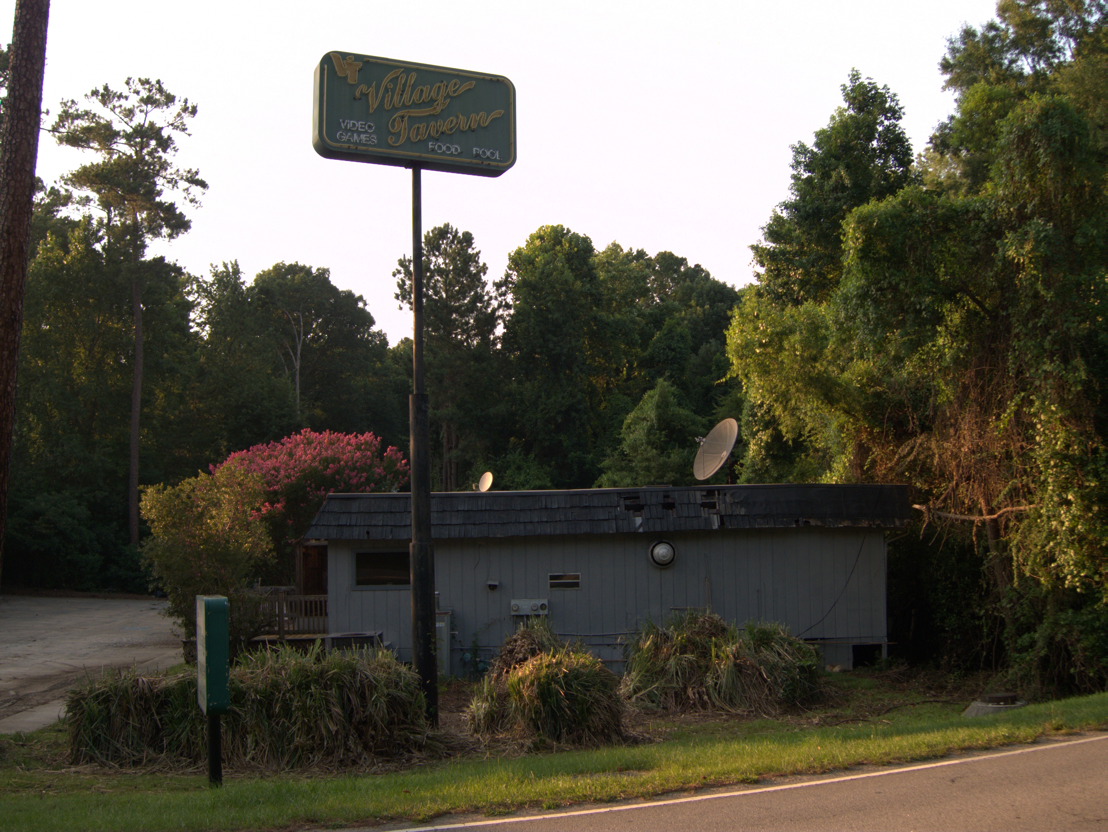
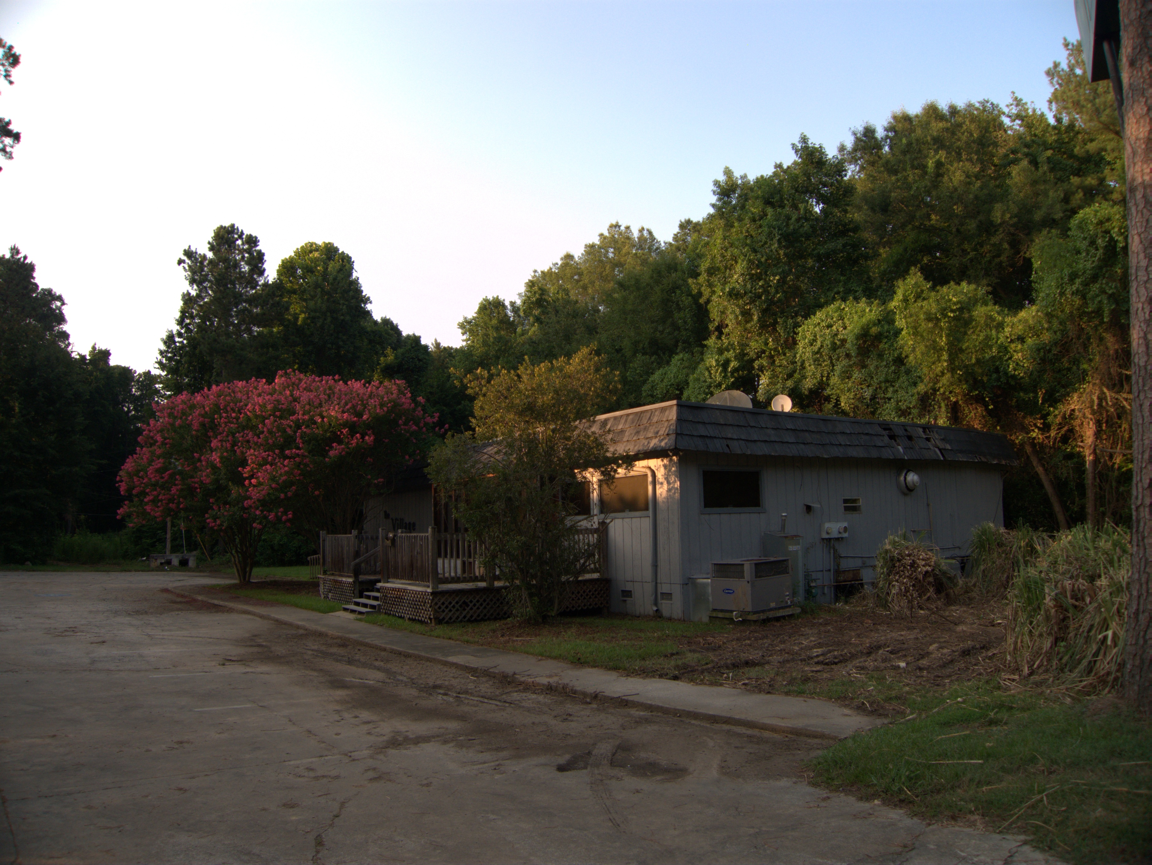
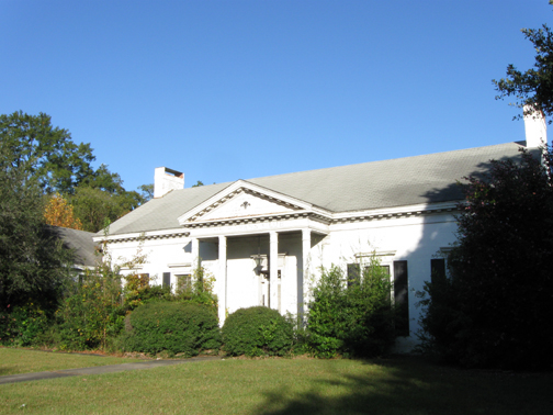
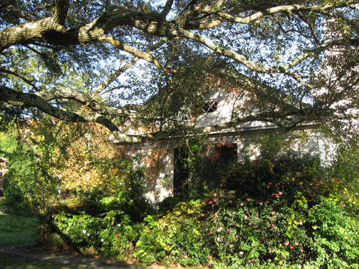
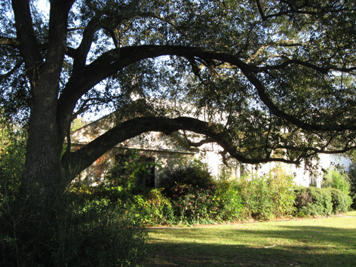
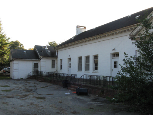
I finally got around to taking some pictures of The Village Tavern. This place was on Berryhill road, which is a frontage road on the north side of I-20, starting at Bush River Road and going east. I did not take it all the way to the other end, but it seems a fairly quiet road with very little traffic (though there is, of course a constant rumble from I-20 itself).
The area where the tavern building sits is quite pleasant. Visibility of I-20 is mostly screened by vegetation, and the tavern plot is very lush and grassy with Stoop Creek running behind the building, under a Berryhill Road bridge, I-20 and eventually into the Saluda River.
The tall neon sign at the edge of the property was the only part visible from I-20, and I would see it for years as I drove past either on errands in town, or on my way back to Aiken. Somehow I never got around to checking the place out while it was still open though.
Commenter Walt wrote this back in February:
The Village Tavern, 214 Berry Hill Road, is closing. It was established in 1968 and has been a local watering hole, pool hall, sports bar and grill for at least two generations of Columbians in the St Andrews area. Our group started having a boys night out on Thursday night back in the early 60’s when the Columbia Speedway was still open. Our hangouts then was the Tap Room on Lower Main and Don’s in Five Points. When Don sold out and moved on, we started hanging out at what is now the No Name Deli on Elmwood. When No Names expanded the dining area and closed the bar, we moved to the Village Tavern and have ben there ever since. I guess after next week we will have to find yet another gathering place suitable for a bunch of fussy 70 something year old, but young at heart, men who collectively are a store house of knowledge of, and enjoy talking about, old Columbia and Grand Strand resturants, cafes, bars, drive-ins, pool halls, road houses, etc., etc. from the late 40’s to the present. Also Carolina sports back to before the last Big Thursday and the McGuire glory days. And the stories get better and better as time goes by, we just need a place to get together to rehash them.
I hope they found another place!
Dry Goods Store / The Flanigan-Clement Candy Company / Paul D. Sloan Interiors (moved), 927 Gervais Street: late 2000s (etc) 2 comments
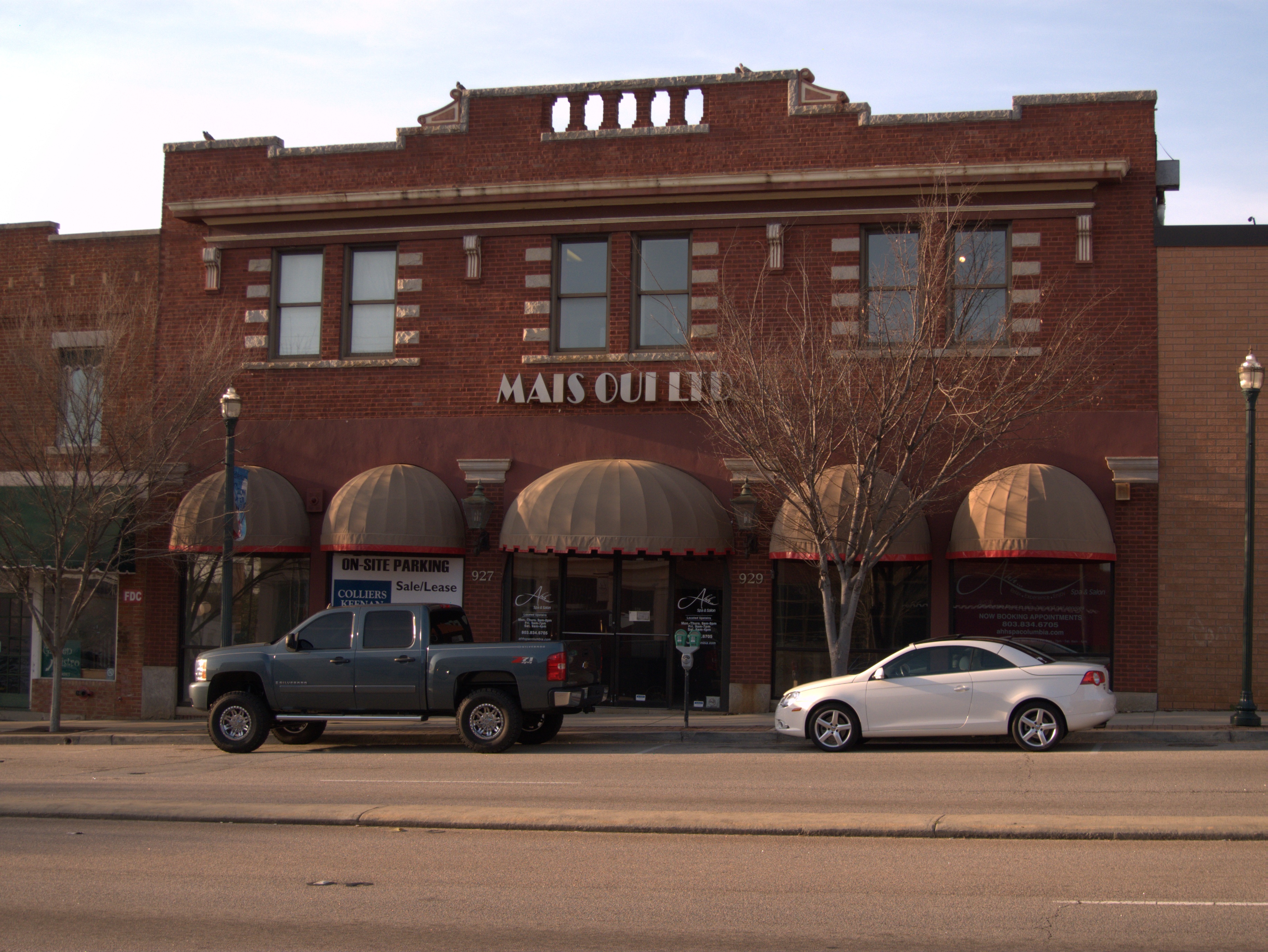
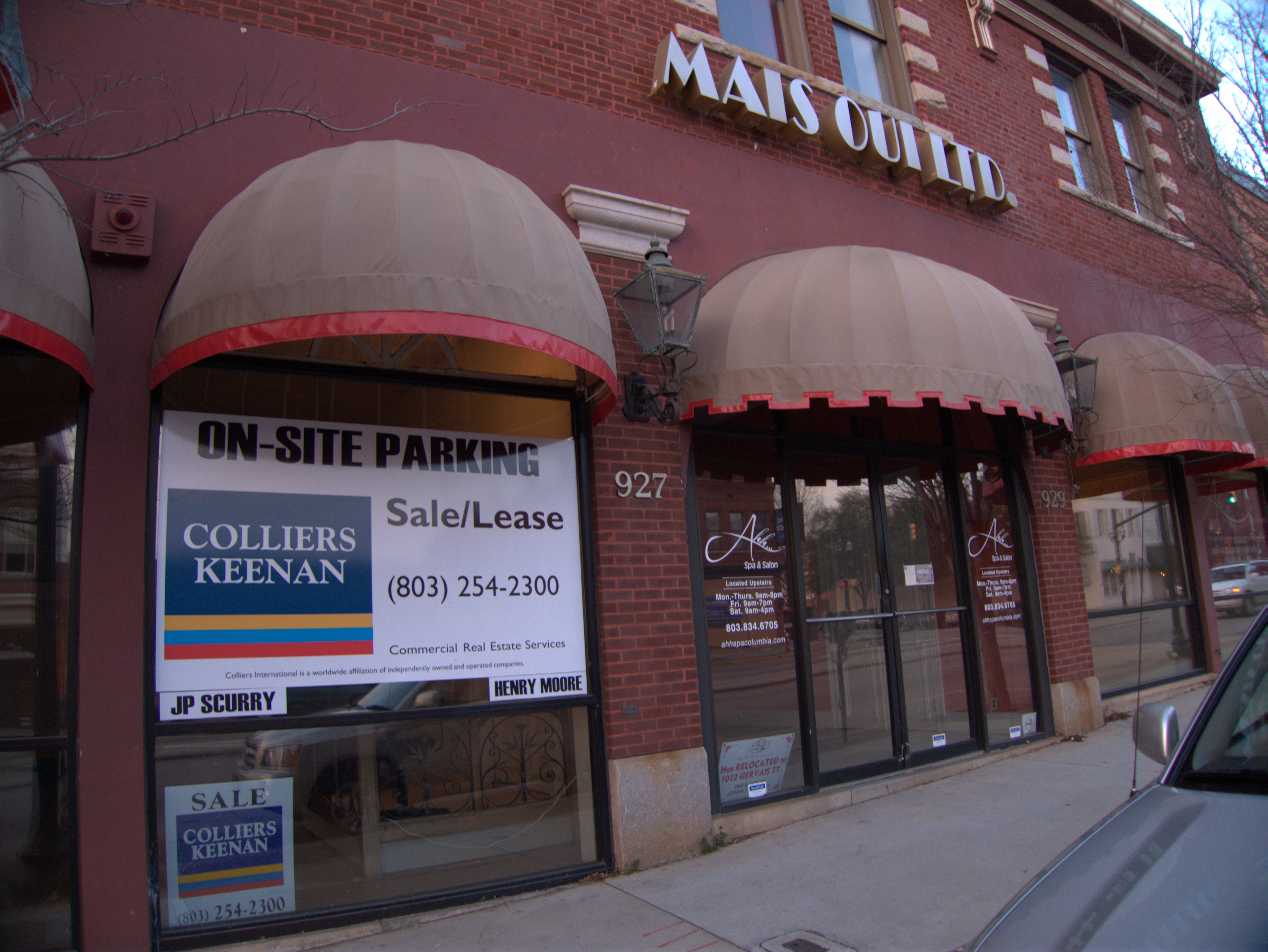


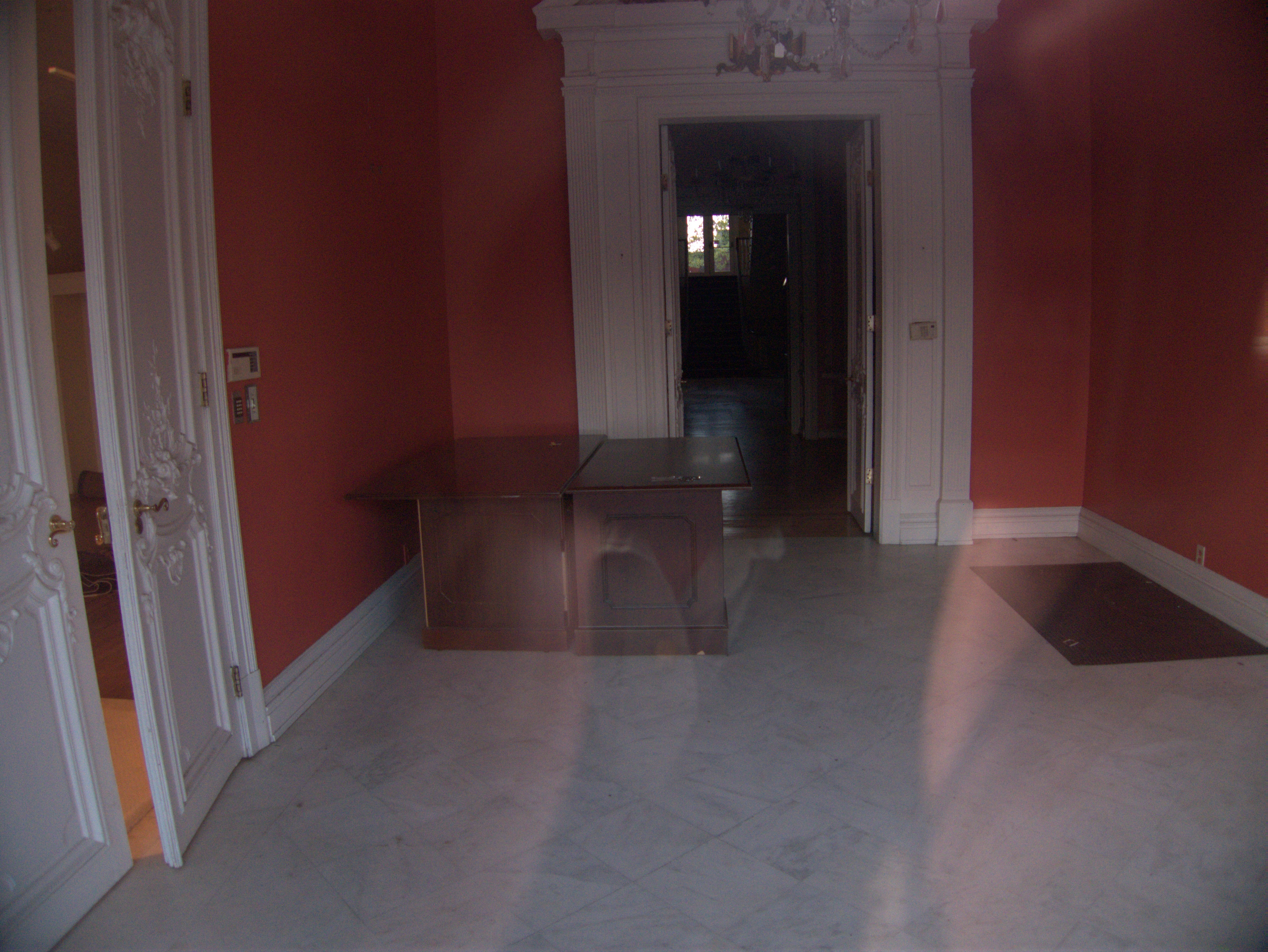
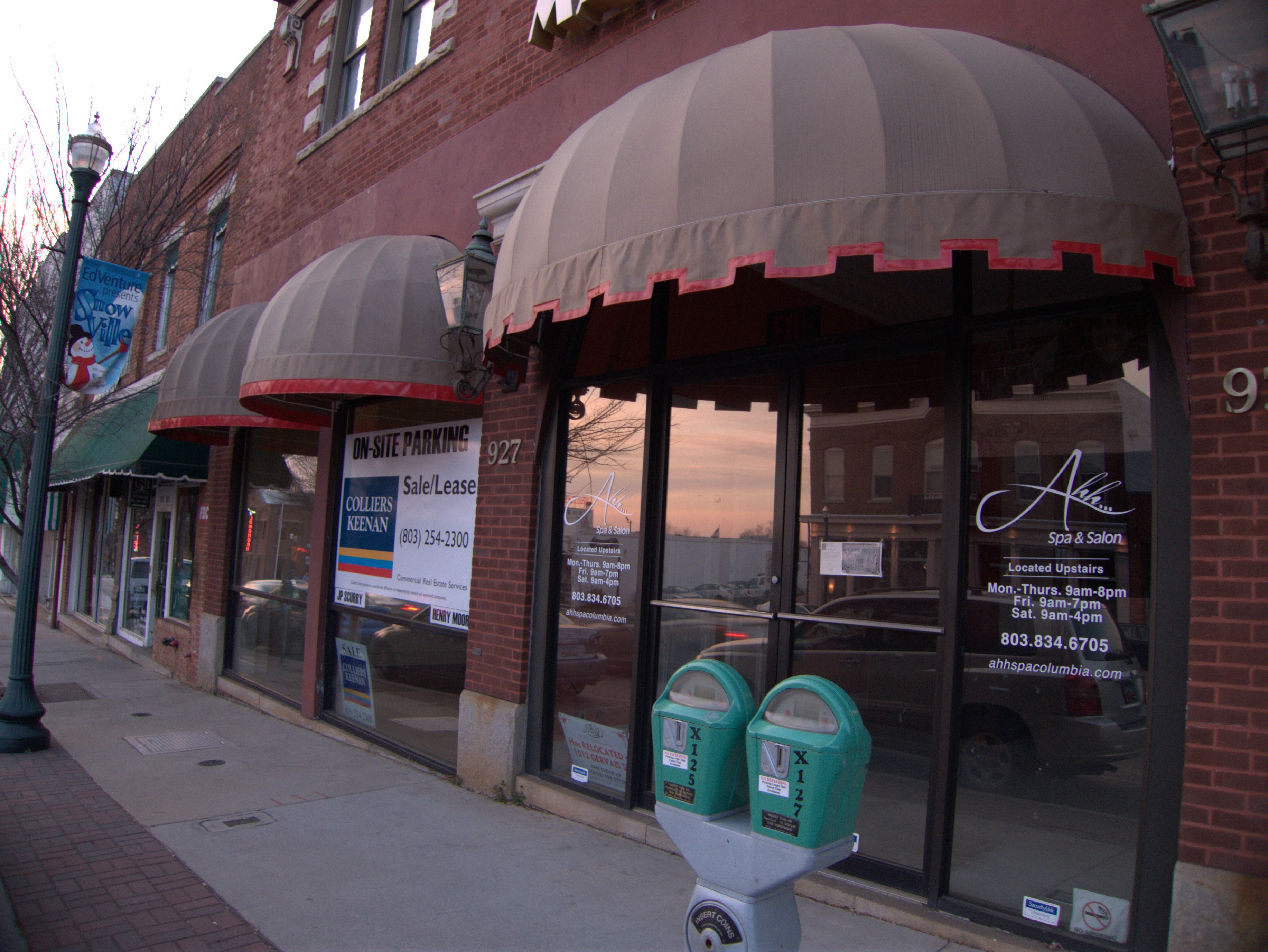
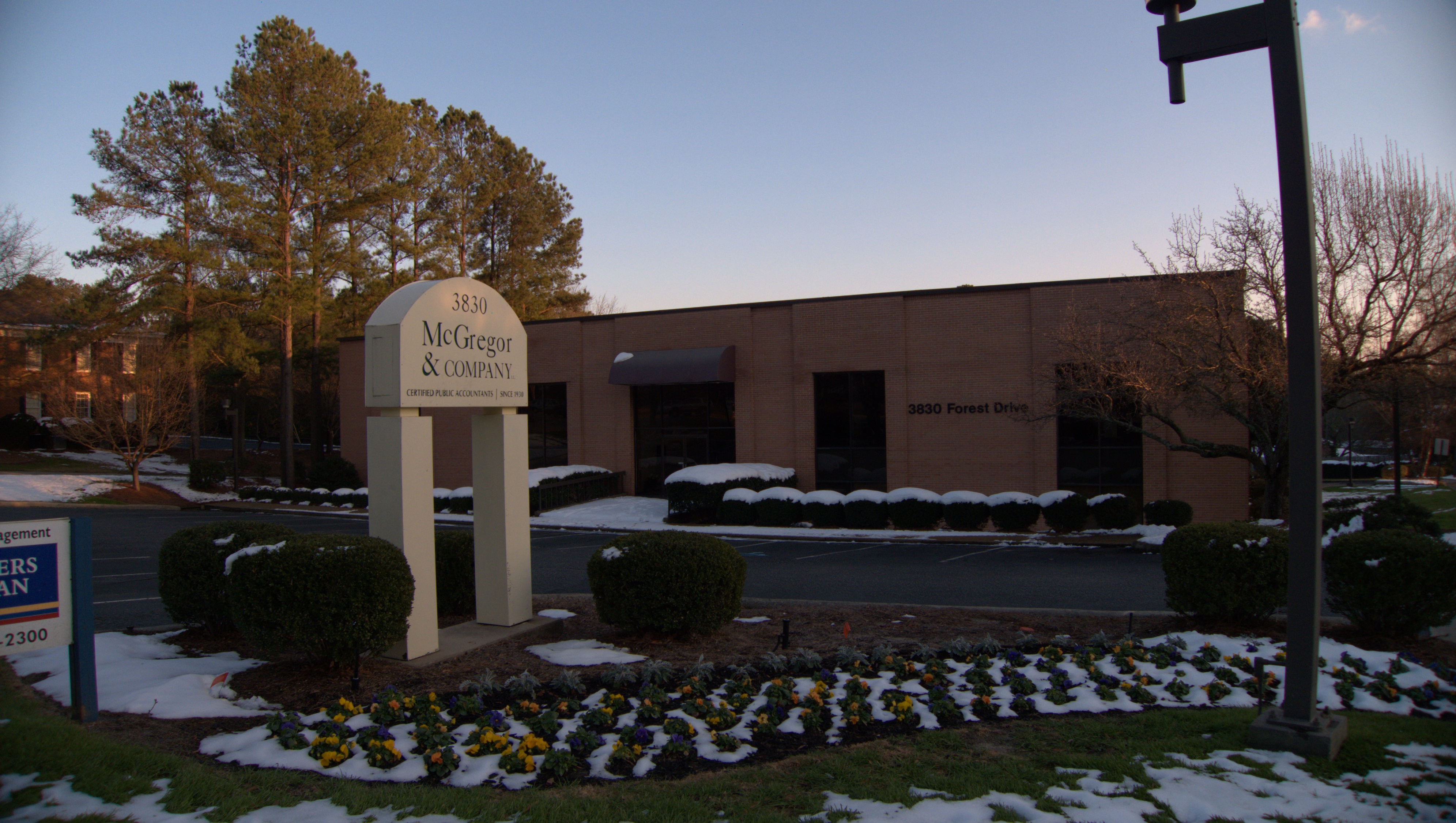
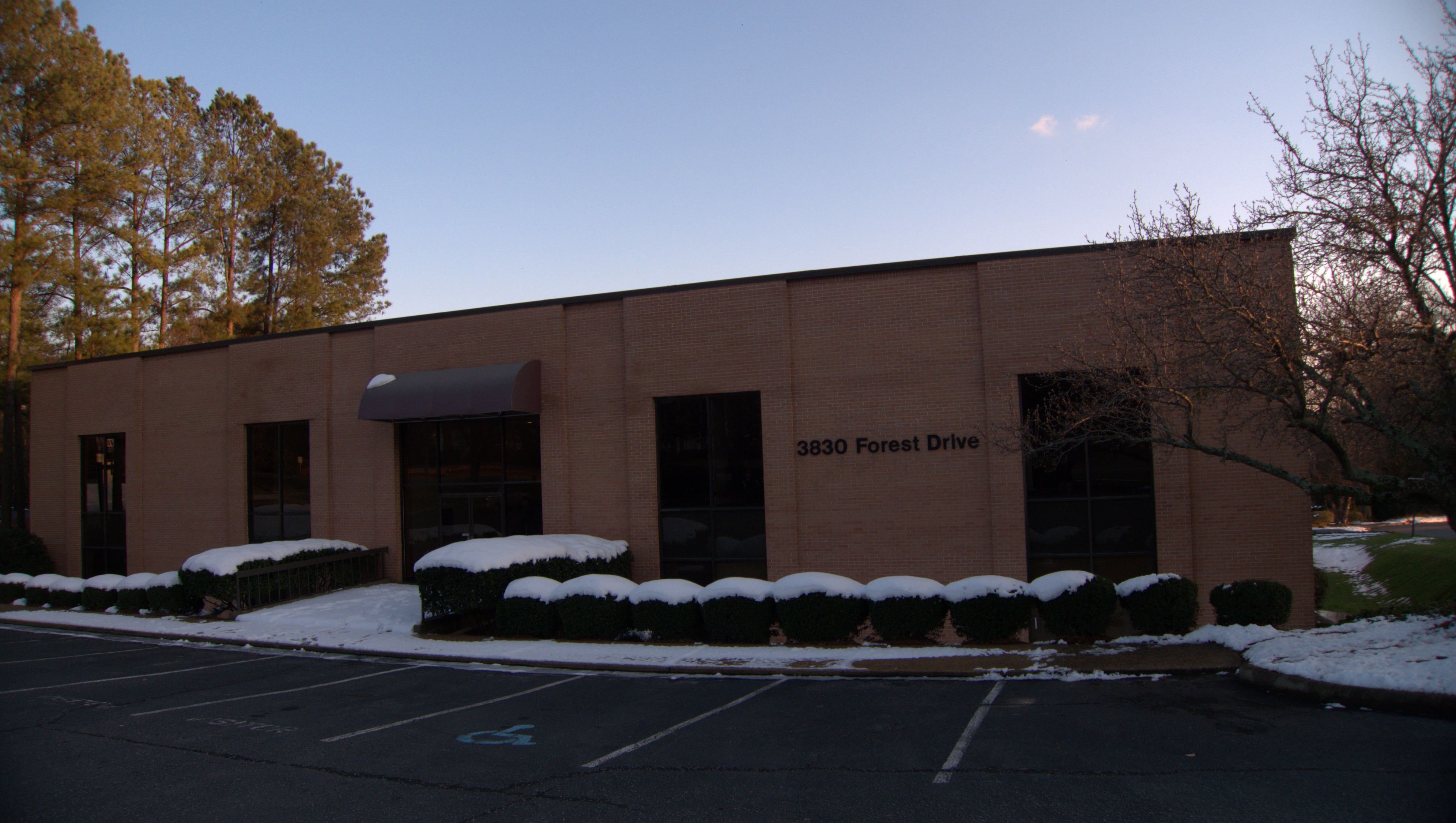
I noticed on my Vista stroll a few weeks ago that part of the Mais Oui building on the north side of Gervais was vacant. Apparently the last occupant, Paul D. Sloan Interiors relocated down the hill a little ways. The building is quite nice, and I found this information in a 1983 application to the National Park Service for entry in the National Register of Historic Places:
54. 927 Gervais Street. This two-story brick building was constructed ca. 1911 as a dry goods wholesale store. The first story has four brick pilasters with granite bases and capitals framing a central entrance and its flanking display areas. The second story has three paired one-over-one sash windows with granite sills and alternating granite and brickwork surrounds. A projecting metal cornice with brackets is located above the second-story windows. A stepped parapet with granite coping and a central brick balustrade is at the roofline. An original second story balcony, a first-floor cornice, and the original first-floor doors and windows have been removed and new doors and windows installed between the brick pilasters. The interior of the building has also been remodeled.
An interesting, if frustrating, story from The Columbia Star (apparently based on old reports from The Columbia Record) gives the candy store information, and this bit of excitement:
About 8 am, on July 23, 1921, John R. Martin departed his home at 1420 Calhoun Street. He was driving an Essex roadster owned by the Flanigan-Clement Candy Company, a local wholesale firm, whose emblem was painted on the right door. As the company’s primary traveling salesman, he made some deliveries to various local customers. Around 3:30 pm, having completed his itinerary, Martin was returning to Columbia along a rural roadway in Lexington County. He was heading back to the main store at 927 Gervais Street. The salesman did not realize that he was about to have a thrilling experience to tell upon reaching his destination.
He was approximately two miles from Broad River Road when he noticed a Ford touring car straddling the road. Martin recalled encountering this vehicle ten minutes earlier at a crossroads. Apparently, there were no dwellings along this isolated stretch of roadway. Two white soldiers, in full uniform, were standing in front of the automobile. With their hands they were beckoning him to stop. A third trooper suddenly emerged from some nearby foliage brandishing a Winchester rifle. His two companions also had drawn .45 caliber Colt revolvers.
Who knew the candy business was so dangerous?
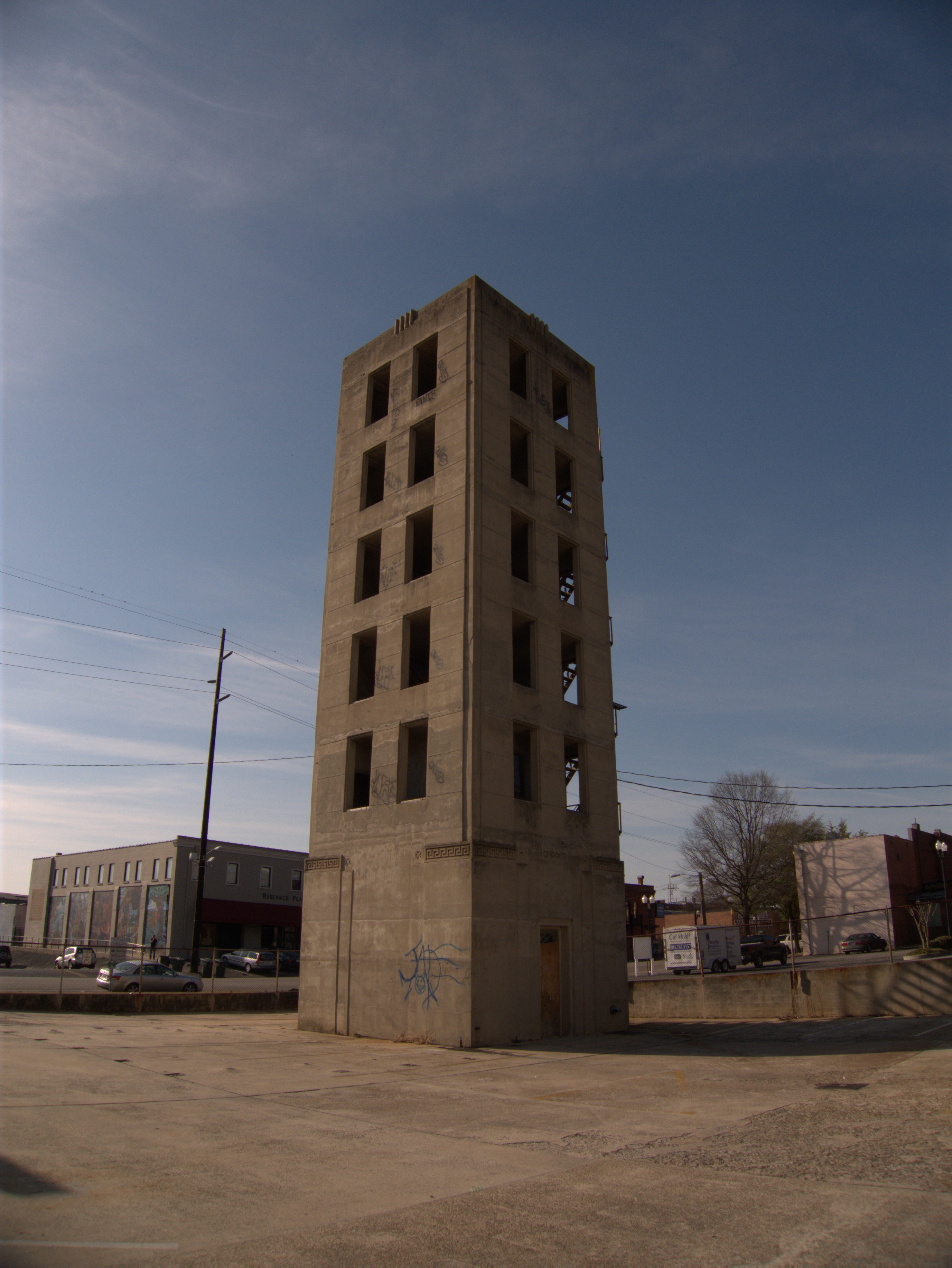
Columbia Drill Tower, Park Street: 1980s(?) 5 comments
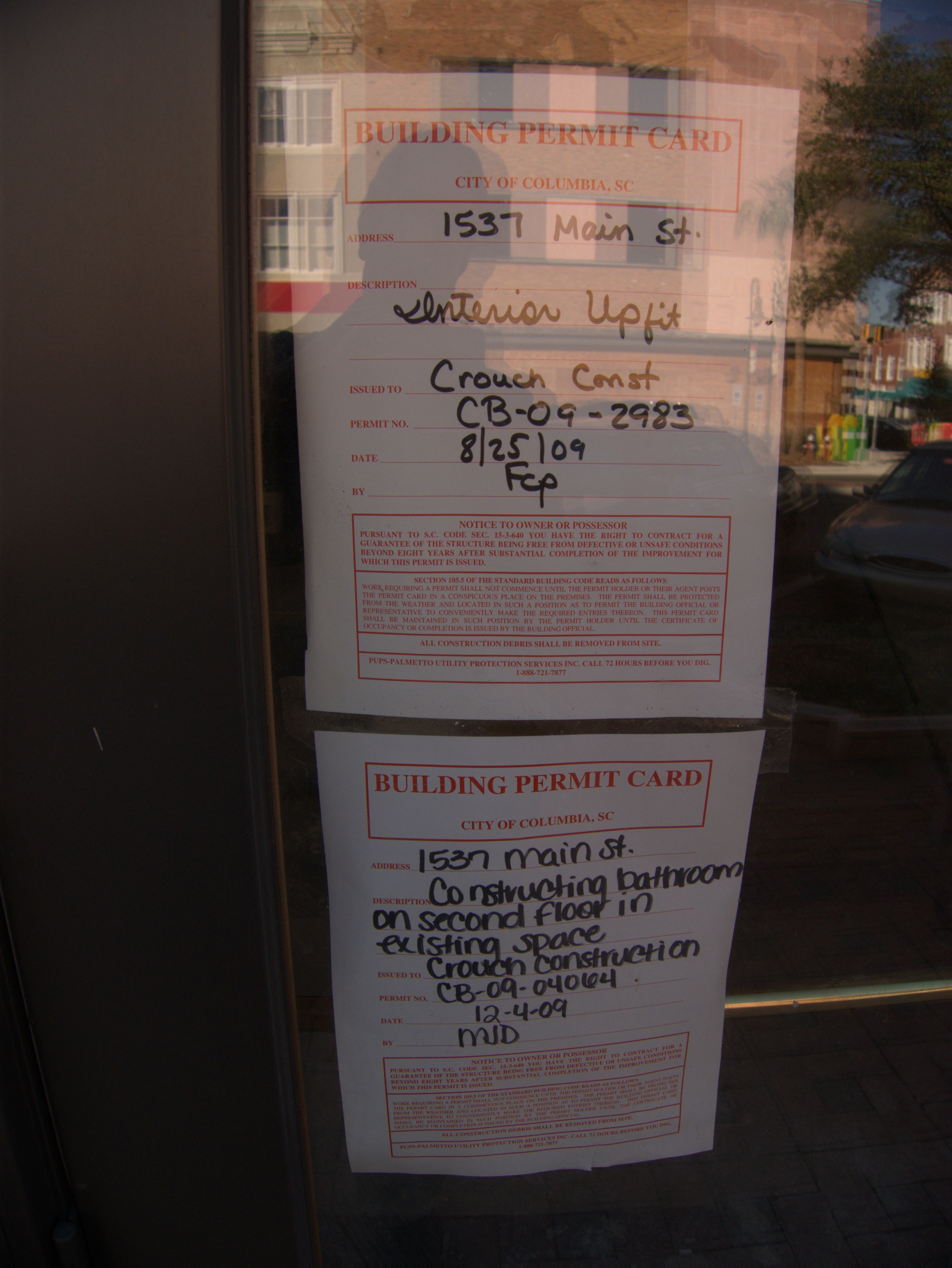
Lorick & Lowrance Mercantile / The Bank of Columbia / The Argyle Social Club, 1537 Main Street: late 2000s 3 comments
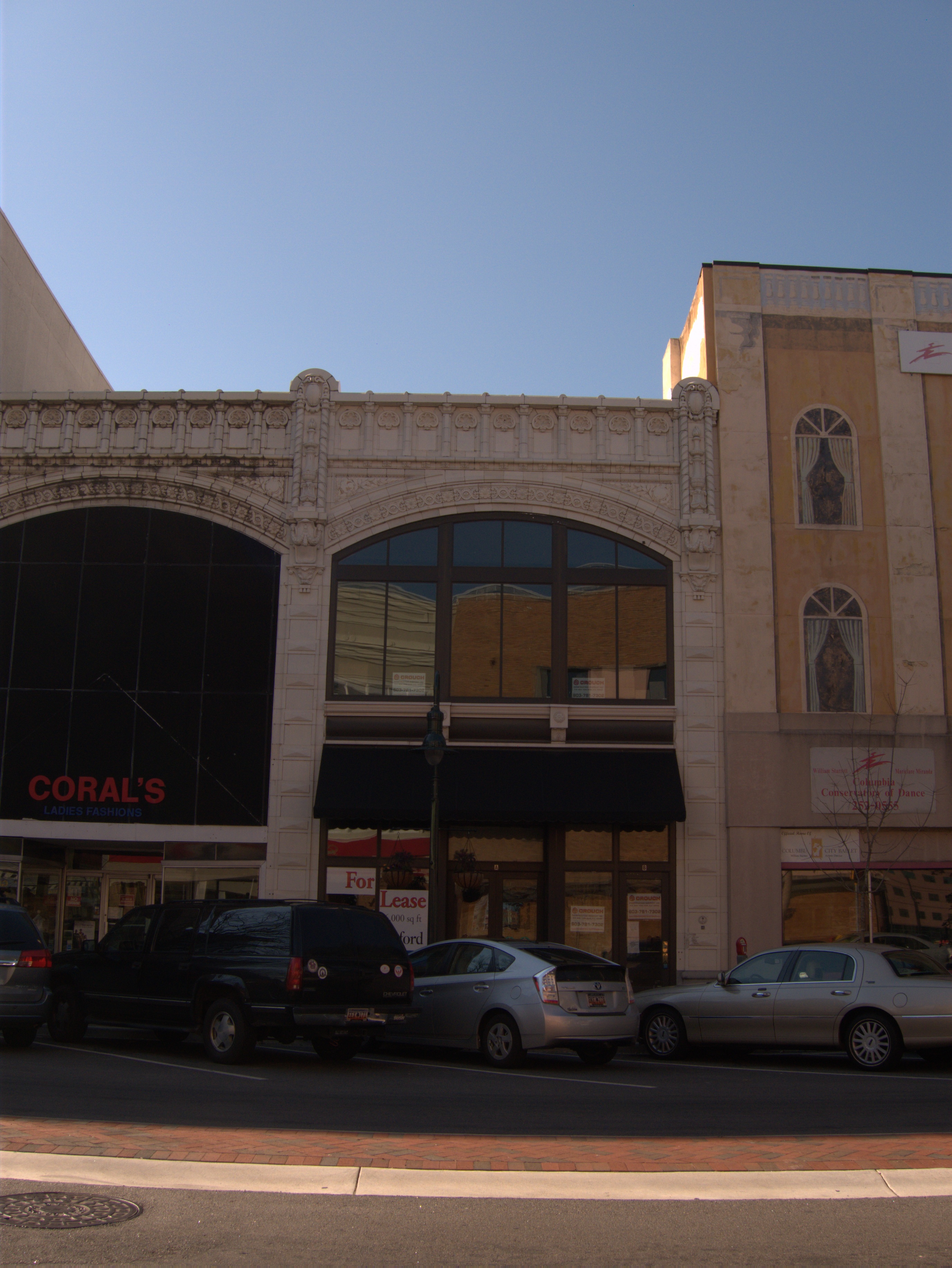
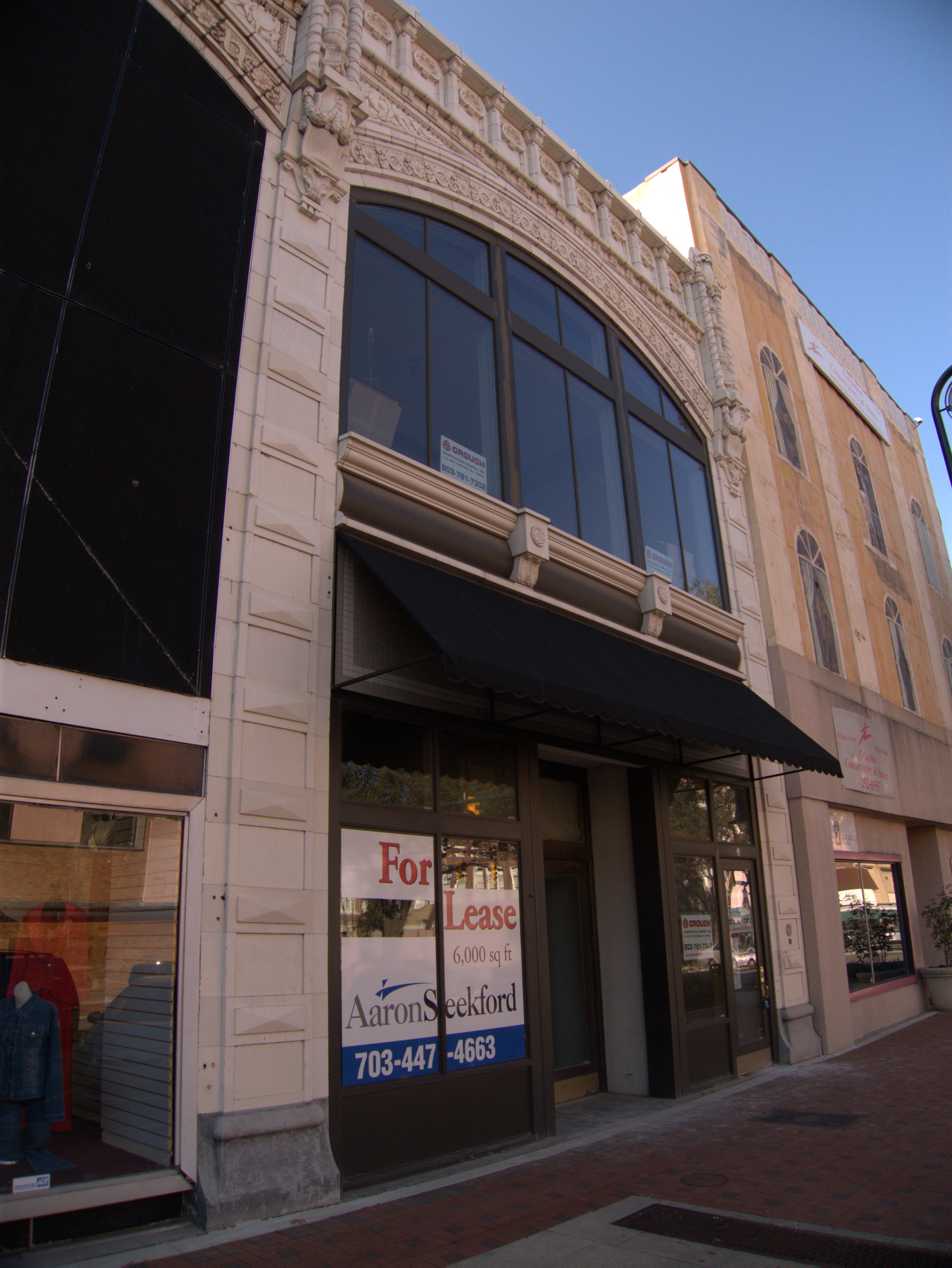
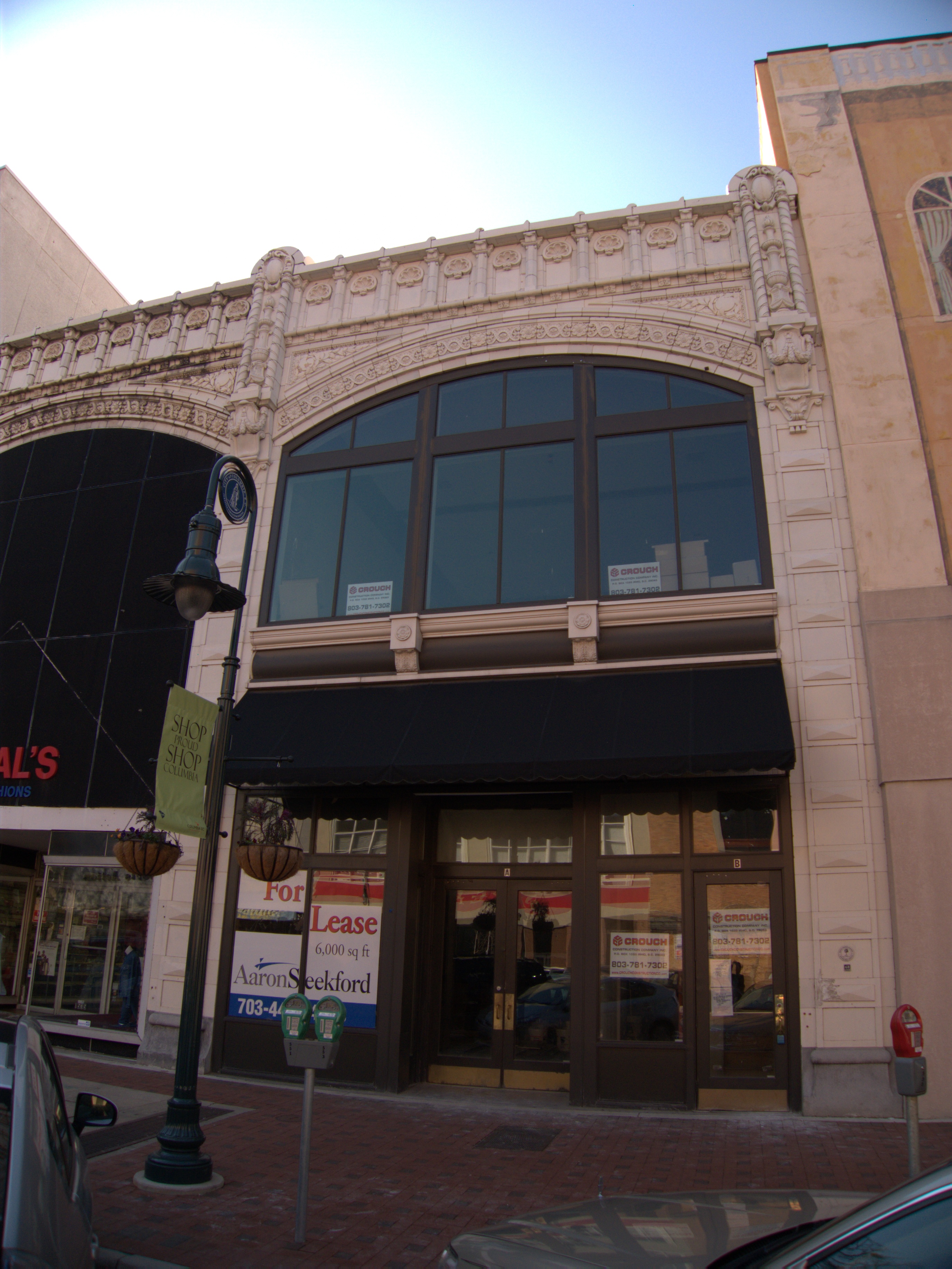

OK, I'm not entirely sure what to make of this one. The Lorick & Lowrance Mercantile Building is another of those great old Main Street buildings, with all the fancy work on top, and is on the City of Columbia landmark list.
I don't know what Lorick & Lowrance Mercantile originally sold, but the name suggests general retail merchandise. Anyway, it seems prosaic enough.
Where it gets a little odd is with the introduction of the Columbia Atheneum and Argyle Social Club. If you go to the "history" tab on this site, you'll find the story of a 150 year old Columbia high-rollers club "[whose] location has been kept hidden from the general public" -- It almost sounds like a put-on, your 2nd grade secret-clubhouse on steroids..
At any rate, the plan apparently was to come out of hiding, sell shares and buy the Lorick building. (There's a litle more information here). Since this was all supposed to happen in 2007 and the building is for lease today, I would say that something went wrong.
Interestingly, the building now has its own web site..
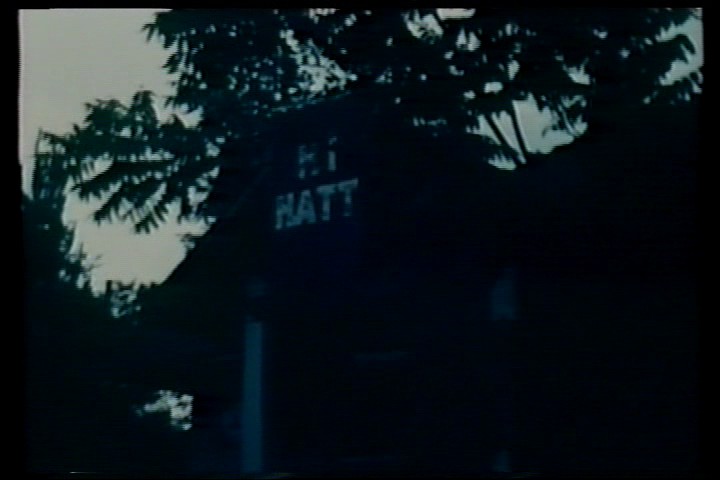
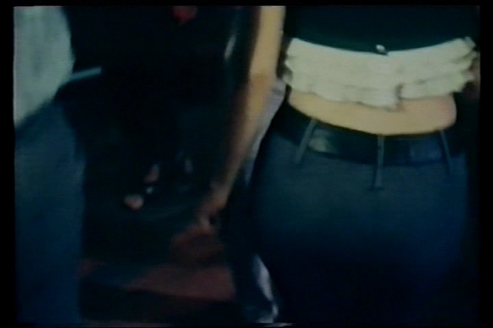
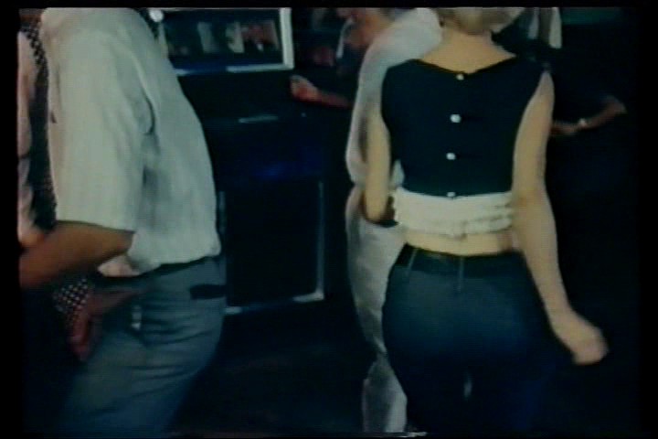
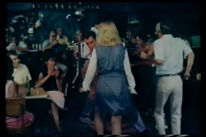
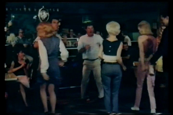
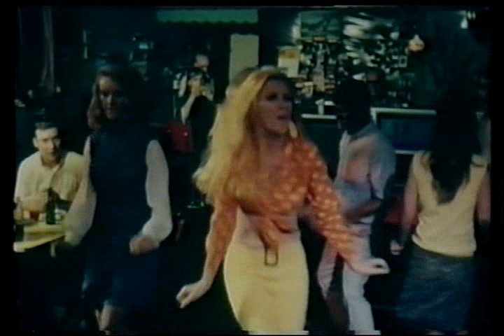
Hi Hatt Drive In aka The Hi Hatt Club, 3830 Forest Drive: 1973 75 comments
UPDATE 7 June 2016 -- Many thanks to commenter Mandy for sending these pictures of the Hi Hatt:


Original post:

Well, there have been a lot of people over the past few years urging me to do this post. I have always put it off up until now as I have no personal memories of The Hi Hatt Club, and though I must have seen it many times up until I was 12, I cannot even recall the building. I was always hoping that I would run across a picture of the club, or would find an old ad that I could use to hang a post on, but that seems destined not to happen, so I will go with what I have been able to establish, and by consolidating various mentions made of the place in the comments.
Here's what I found out by looking through old phone directories last week. The Hi Hatt Club first appears in the Columbia Southern Bell listings in the August 1957 directory. The last time it was listed was in the December 1972 directory. At the start of its run, the phone number was given as SU-7-9143. That number was retained in each directory though with the advent of direct dialing the prefix changed from Sunset to became 787-9143. The name the club used for its directory listing was always Hi Hatt Drive In, and it listed under Clubs in the Yellow Pages though it never bought a Yellow Pages ad.
Given that other sources state that the club started in the 1930s, I'm not sure why listings only started in 1957. I suppose that in those days not every road-house felt it needed a phone, or perhaps the listing was under another name.
Here's what the Town of Forest Acres says on their web site in what seems to be a semi-official history of the town:
The town limits formed an irregular rectangle that paralleled Forest Drive. The original area of incorporation was two square miles with the northern and southern boundaries lying one half mile on each side of the road. The eastern boundary ran north to south a thousand feet to the east of Gill Creek. The western boundary lay two miles to the west paralleling the eastern boundary. The boundaries did not change right away, but over the years the city grew to the east and primarily to the north. Forest Acres was planned to be a residential area. Existing businesses were grandfathered in, but new businesses were not to be opened. Because of loopholes in the laws, this was not enforceable. To the chagrin of the local residents, the old Bethel School at the comer of Forest Drive and Landmark Drive (3830 Forest Drive) had closed, and the Hi Hatt (pronounced High Hat) Club had opened in the building. The Hi Hatt Club, an early form of nightclub, was in the area in 1935. The city founders would have liked to have seen it close, but it managed to stay open. Over the years, especially in the 1960's, the Hi Hatt Club was rumored to be a place of prostitution, or a "whore house," as such operations were called. Mothers shielded their children from it, but the Hi Hatt Club's reputation made it a big source of interest and a hot topic of conversation for teenage boys. Frowns and concern could never close it, but a good financial offer to purchase the land to construct office buildings finally brought it to an end. The city officials, from the beginning on, wanted only wholesome businesses in the area with protection and privacy for the nearby residential properties.
Here's a bit of information on the appearance of the club from commenter FirstDennis:
Does ANYbody remember the Hi Hat Club on Forest Drive, not too far from Beltline? I asked William Price Fox about it, because he is a wealth of info on stuff like this, but he cannot recall it. I swear I’m not making it up, though. It was a white wooden building. Had a neon sign shaped like a top hat.
Commenter BR suggests the place was informally known as Goldie's:
......
......
Commenter Michael Taylor passes along this information from his uncle:
Hi-Hat Club update: My 91 year old uncle is the last remaining person of that generation alive for me personally, and I’ve been hitting him up for city history a little at a time so as not to wear him out. The latest nugget should tickle all the “Hi-Hatters” out there. Dig this, before it was a honky tonk the building was a 2-room schoolhouse and my uncle went there for a bit. Unfortunately he is not a photographer and doesn’t even have a photograph of his old garden center. Oy vey!
Something a little less certain that I remember from my father talking about the Hi Hat Club back when it was still a working honky tonk in the 1960s is his insistence that a couple of scenes for the cult Robert Mitchum movie “Thunder Road” were filmed there in 1958 or so. According to this wikipedia entry for the movie, most of the principle filming was done in Asheville, NC, so this at least puts the production crew to within a few hours drive. It’s not uncommon to film several locations for one final composited location. In other words, if you were filming a honky tonk scene, you may film the interior of some place on the outskirts of Asheville and the exterior of some distinctive juke joint in the suburbs of Columbia SC and then edit them to look seamless. It seems excessive, but often one place looks better on the outside and the other place looks better on the inside and because they can, film crews do this stitching all the time and you’d never know it.
Going against my father’s story is that the South Carolina film database doesn’t have “Thunder Road” listed, however it mostly lists the films that have been primarily filmed here. It does list a “Thunder In Carolina” stock car movie (with Rory Calhoun and Alan Hale, Jr., the skipper from “Gilligan’s Island) filmed in Darlington in 1960, which my father could have been confusing with “Thunder Road”. But on the side of a film crew having filmed a few scenes at the Hi-Hat Club for “Thunder Road,” here is an interview with Mitchum’s son James on the 50th anniversary of the film where he mentions that some of the inspiration came from their South Carolina cousins’ moonshining and fast driving. I could see Mitchum coming down the short drive from Asheville for some scenes at the Hi-Hat Club, it was such a wild looking little honky tonk. I suppose one way to solve this would be to rent both movies and watch them with hawk eyes and keep an eye out for that crazy neon sign on top of the club. And speaking of signs, wonder what ever happened to that sign, bet it’s at the bottom of a trash heap somewhere.
I can see that place in my mind’s eye just as clearly as this computer screen, but sadly, 41 years or more later it’s not enough, especially with websites like this. Right this very moment there is a box of photographs with photos of places like the Hi-Hat Club and YOU may know the person who has them.
Comments from anyone who actually visited the club are welcome (and you can be anonymous if it really was an establisment of ill-repute at some point :-)! Pictures would be great too..
UPDATE 14 Dec 2010: I got the Montgomery book for my birthday. You can get it here:
Anyway, there is a section on the Hi-Hatt Club. To answer some questions asked here:
1) Yes, 'Goldie' was the proprietress.
2) The 1968 movie with scenes at the Hi-Hatt Club was not Thunder Road, but The Road Hustlers. (It does not seem to be available on DVD or VHS).
3) The book doesn't definitively settle the question of whether the Club really was a house of ill repute, but states "Due to a renewal of complaints about the Hi-Hatt Club's liquor violations and rumors of prostitution, SLED (State Law Enforcement Division) raided it in 1973.
4) There are no exterior pictures of the club given.
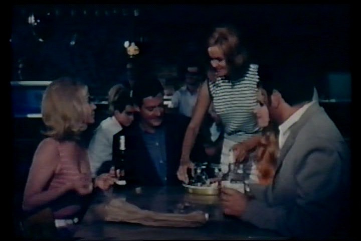
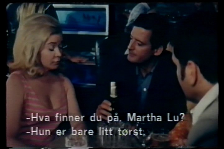
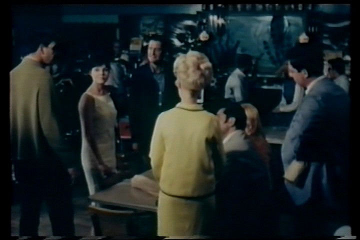
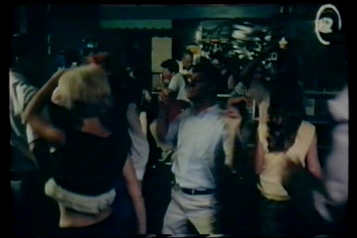
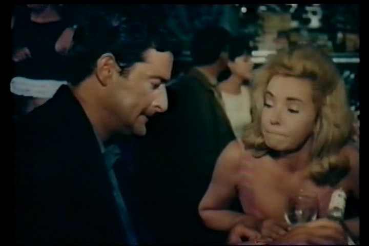
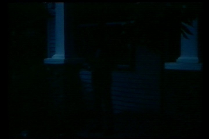
UPDATE 20 March 2012 -- Well, The Road Hustlers has surfaced (subtitled in Norwegian, of course). I have not watched the movie as such, but simply fast forwarding through it leads me to believe there is only one scene set at The Hi Hatt Club, stills of which, and a youtube embed, are below.
The exterior shots at the beginning (Hi Hatt sign) and end (front porch of Hi Hatt) are definitely the club. Unfortunately they are so dark as to be almost invisible. I don't *know* the interior shots for the scene to be the actual Hi Hatt Club, but it seems unlikely that a shoestring drive-in quickie would build a sound set for such a thing. Perhaps some old Hi Hatt patrons can comment..


UPDATE 8 October 2025: Fix Youtube embed, add map icon.
![]()
Shulte-United Building, 1620 Main Street: 1996 4 comments
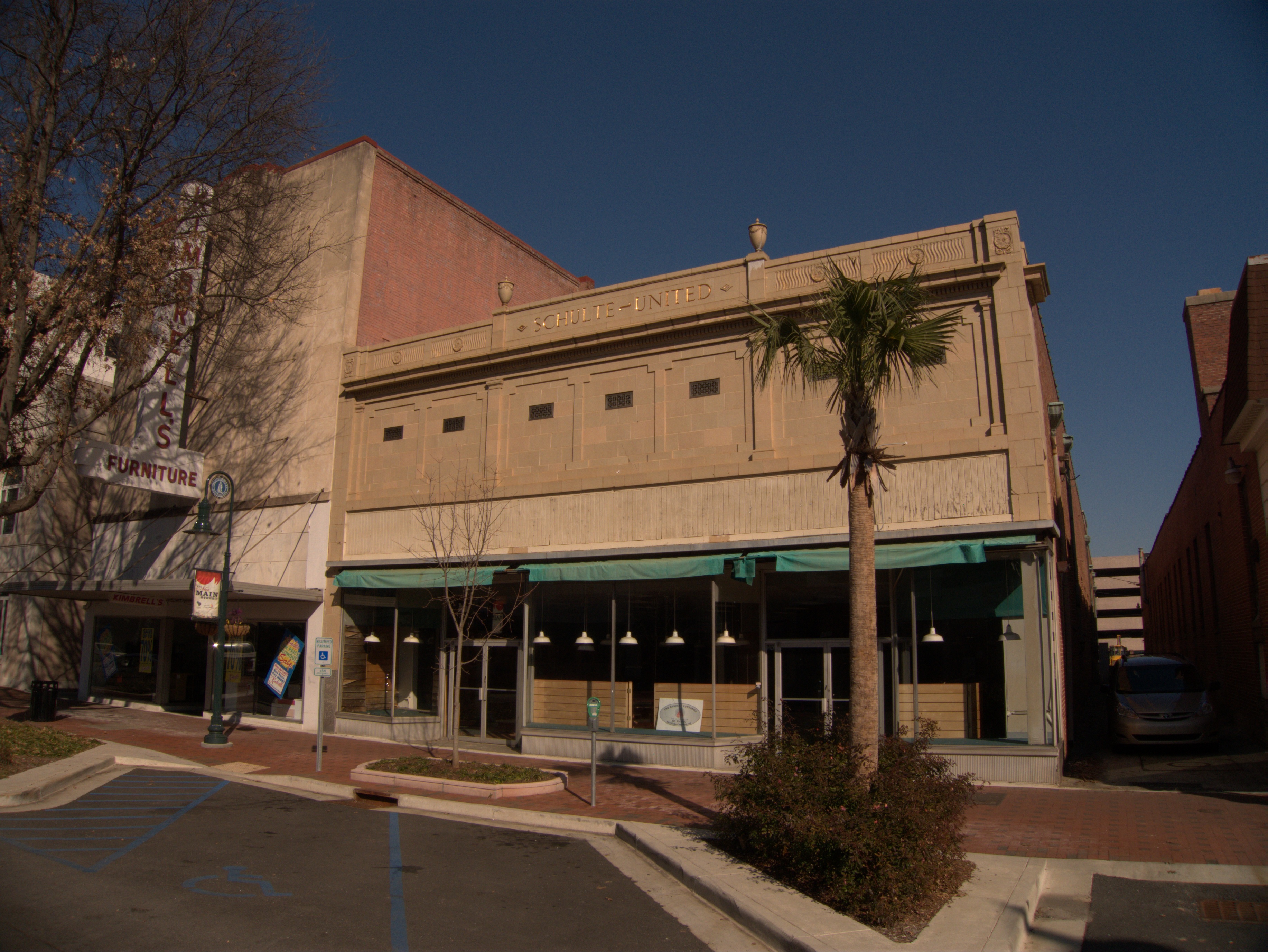
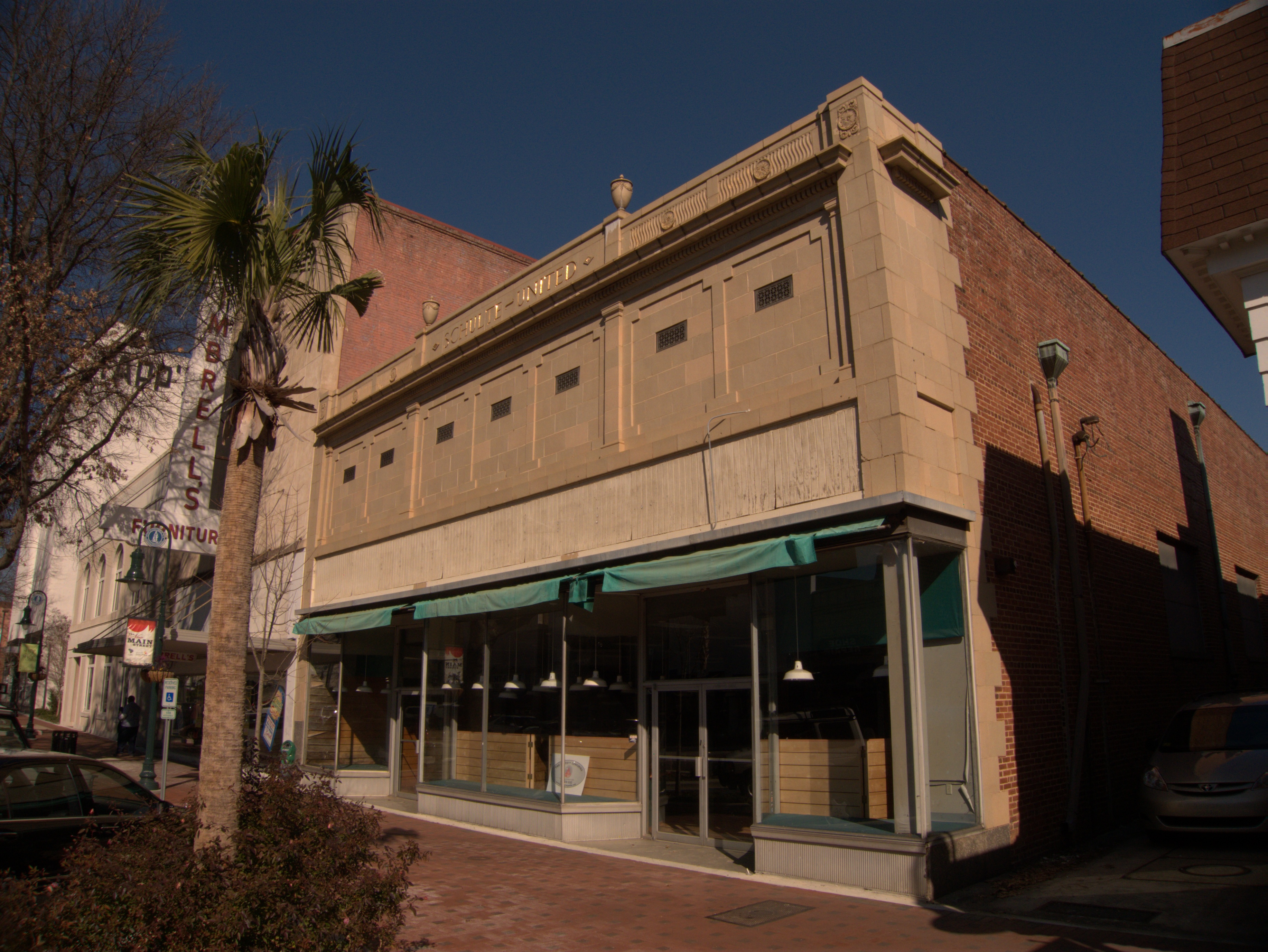
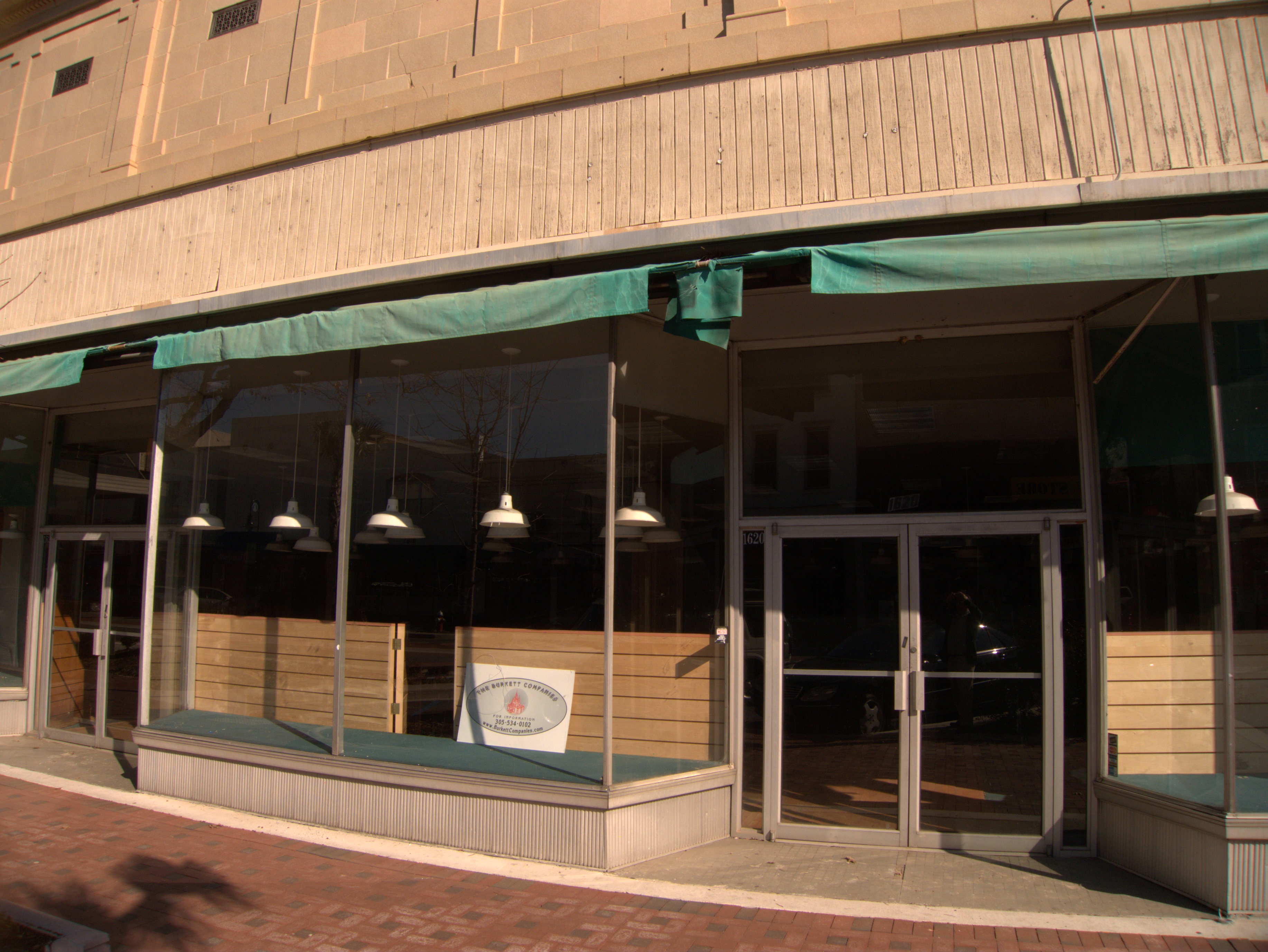
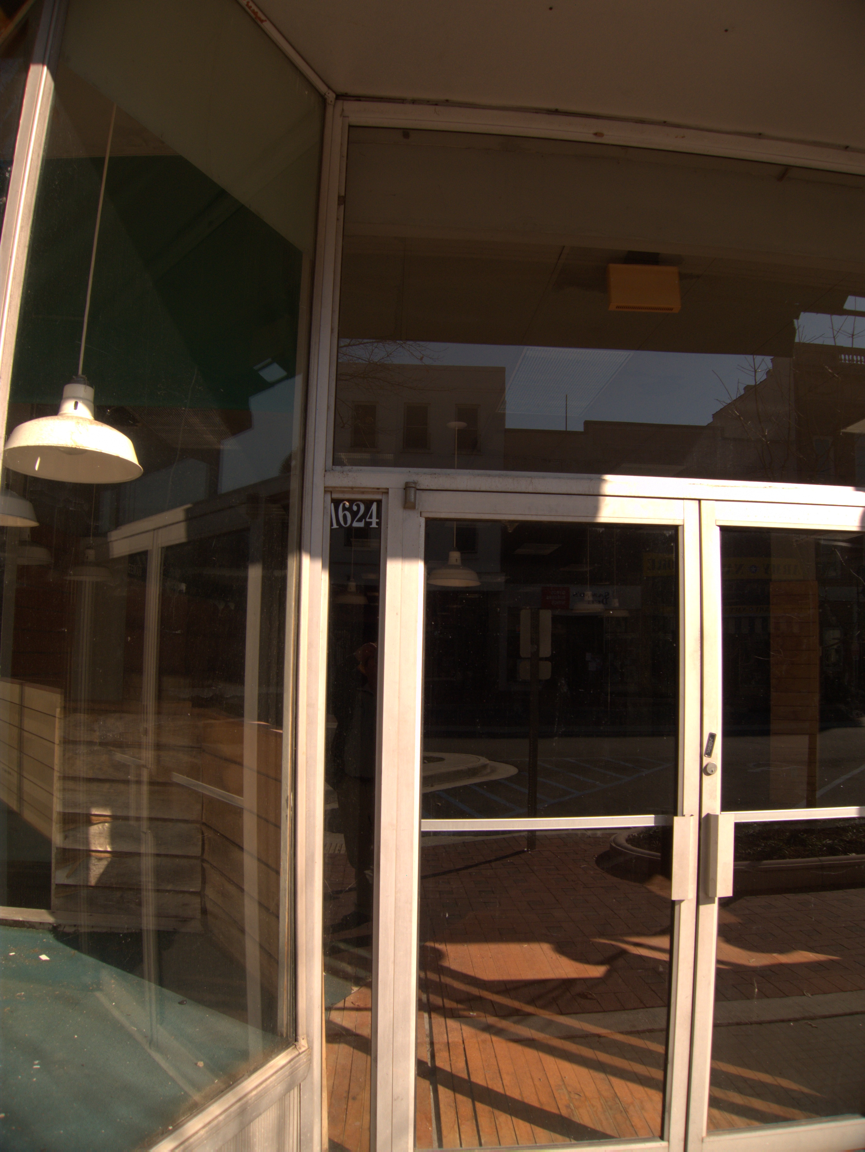

Here's another Main Street landmark, The Shulte-United Building (which also comprises 1624 Main Street). Look at all the gold and filigree along the roofline!
I don't actually know what Shulte-United was or sold, and while I can find out on the web that the place is on Historic Columbia Landmark list, nothing besides that bare fact is mentioned.
Normally, googling a street address will bring up a good bit of useful information about a place's retail history, but the most recent cites I'm getting for this place are that it was the 1996 headquarters for the Cliton/Gore campaign (that web site is still up!)) and the South Carolina Democratic Coordinated Campaign HQ during the same time period. The interior seems to have seen work since then, but if there was another occupant, I'm missing it.
Given the nature of the architecture it's perhaps not surprising that the realty agency whose placard is in the display window seems to specialize in Art Deco properties in Miami.
Brookgreen Gardens Nights Of A Thousand Candles: 11 December 2009 3 comments
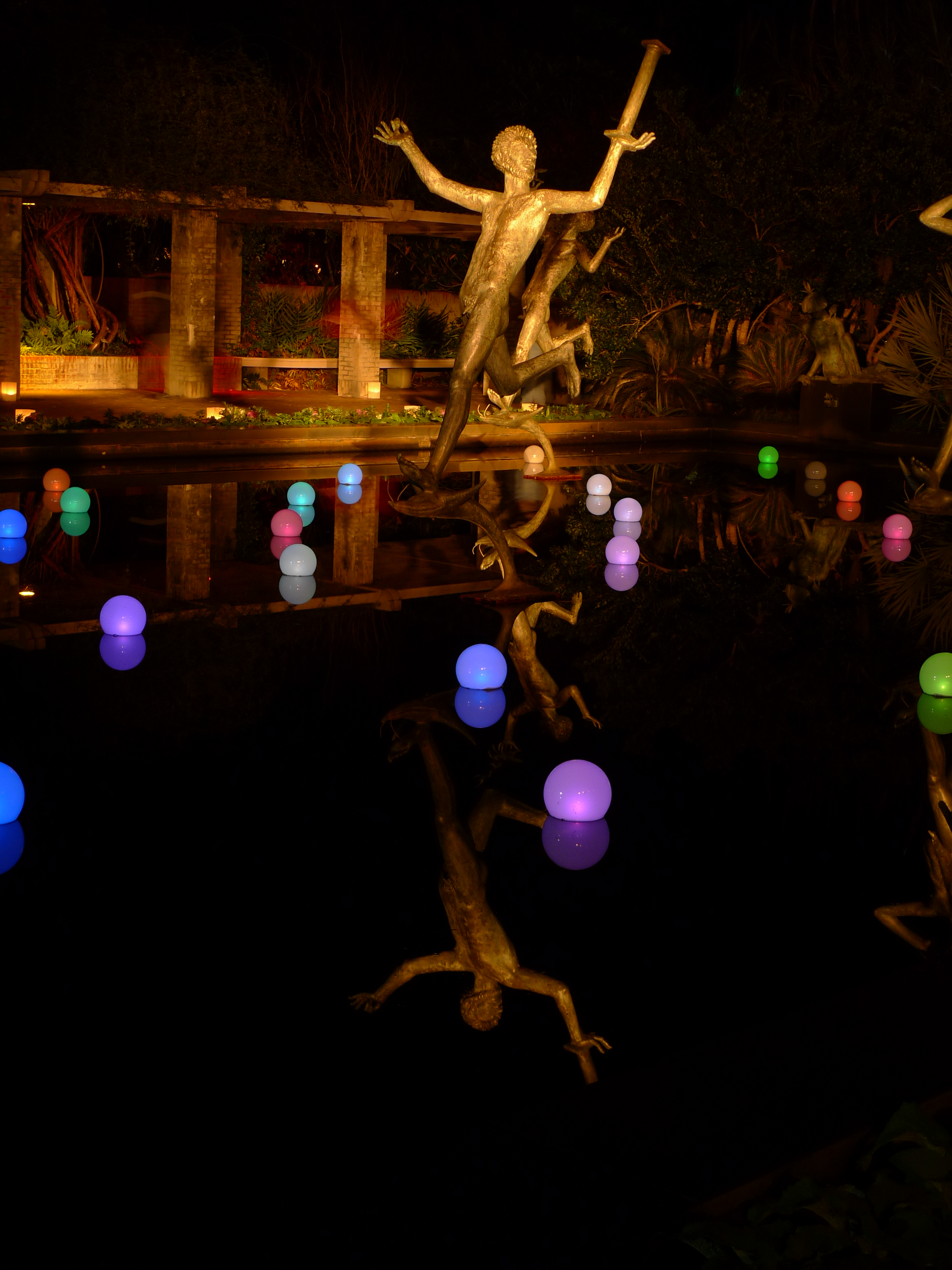
Well, I suppose it's a bit of a cheat to do a closing for an event that will repeat this weekend, but hey, it's a closing for the 11 December viewing date only.
If you can make it to the coast this weekend (17th, 18th or 19th) the show is well worth your time. The gardens are lit as you see, and there are singers, bagpipers, food and drink.
I took my tripod with me this year, set the aperture to f2.0, the ISO to 80 and let the camera set whatever exposure it liked. Often it worked quite well, other times not so much (these are some of the ones I think did OK). The long exposures mean you can see blurs for people walking by in some pictures. It was supposed to be much warmer on the 12th than the 11th, but it was also supposed to rain, so I went out on the colder night. It wasn't too bad except when I was trying to feel the little buttons on the camera and could not find them at all in some cases!
It's all pictures after the jump.
The Trestles, Gadsden Street: 28 Janurary 1991 15 comments
My memory of The Trestles is now rather hazy, but I'm pretty sure they were along Gadsden Street, at the lower end of The Coliseum parking lots.
As the name suggests, they were elevated train tracks, but instead of crossing a river, they crossed Blossom Street. At this remove I can't recall the sequence of events, but I suppose that the current arch on Blossom Street which lets train traffic run under it was done so that the trestles could be demolished. The demolition itself was controversial. Many people considered The Trestles to be a huge eyesore in the middle of the city's new development project, The Congaree Vista. Others considered them an important Columbia landmark and a visible remider of Columbia history. I was living in Fayteville NC at the time The Trestles came down, but I came home fairly often and noticed story after story in The State about it. I came down on the side of leaving The Trestles because I hate for anything to change ever, but that side lost and a search of The State's archive suggests that demolition began 28 Janurary 1991.
Of course, the historicity aside, what I really remember about The Trestles is that is where everyone when to practice parallel parking. I'm not sure exactly why this was other than there was not a lot of traffic under the structures, but I clearly recall driving down there around 1976 to try my hand at it. (I was, and remain, so-so). I don't think the activity was officially sanctioned by anyone, but nobody seemed to have a problem with it. I'm sure today it would be an insurance issue for somebody.
UPDATE 24 November 2009: Corrected typo/thinko for "Gadsden Street".
UPDATE 10 October 2025 -- Commenter E Mathis sent this Trestles picture long ago in a message I just found again:

![]()
Women's Club of Columbia, 1703 Blossom Sreet: 1940 (built) 15 comments
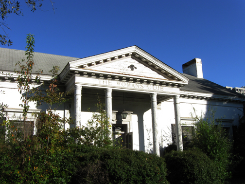

Today's bonus post comes from commenter Dennis, as do the photos:
After driving past a million times and promising myself to take some pictures before USC bulldozes it, I finally stopped and got some photos of the old Woman's Club building at 1703 Blossom St., next to their tennis center.
As you can see it is slowly moldering away. It has achieved a wonderful haunted house feel, and I'm sure it has a thousand stories and a few ghosts. I don't think it's used for anything currently. For years it was a little rundown but still rented a lot for fraternity and sorority parties. I've been to several wedding receptions and parties there.
It's basically one big room with a kitchen on the end, and some tiny side rooms. I peeked in one years ago and there was a wonderful, poster-sized b&w photo in an old frame showing the club in its heyday, with dozens of stylish ladies wearing their best hats and pearls at long banquet tables, taken in the 1940s I'd guess. I tried hard to track down who to ask about getting my hands on it but never could figure out who to talk to.
The Woman's Club of Columbia is still around and very active. They now meet here:
http://www.gfwc-sc.org/headquarters.htm
Columbia City Council records show that they were given permission and "encouragement" to put up a plaque explaining the history of the old Blossom St. place. It hasn't happened yet. The building has been nominated to go on the federal List of National Historic Places, but I don't think that has happened yet either. It's currently owned by USC and valued at $700,00 but I'm sure the acre and a half lot is worth a lot more than that. And the huge oak trees are priceless.
UPDATE 8 November 2009: Added '1940' to post title.
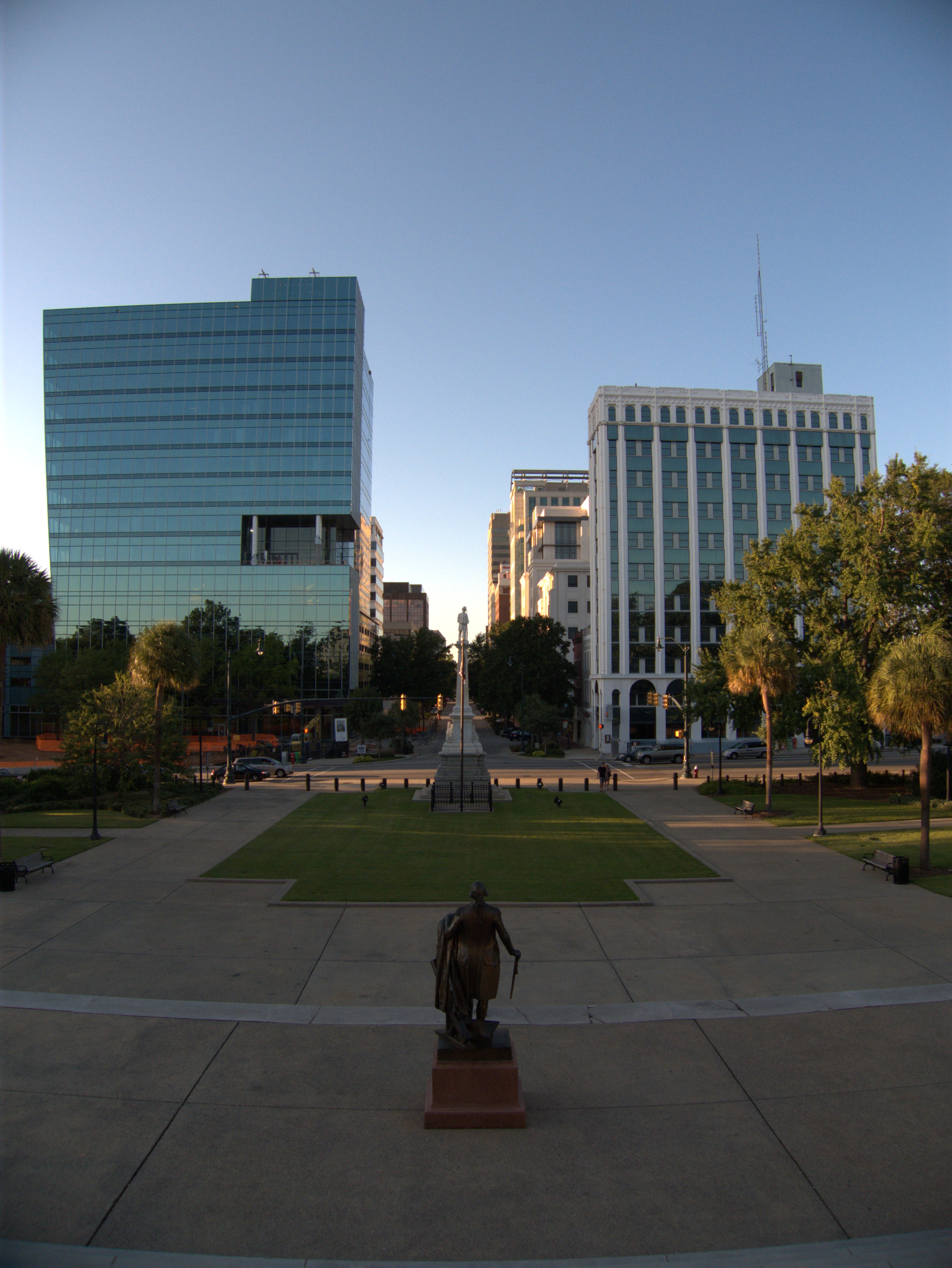
Wade Hampton Hotel, 1201 Main Street: Early 1980s 53 comments
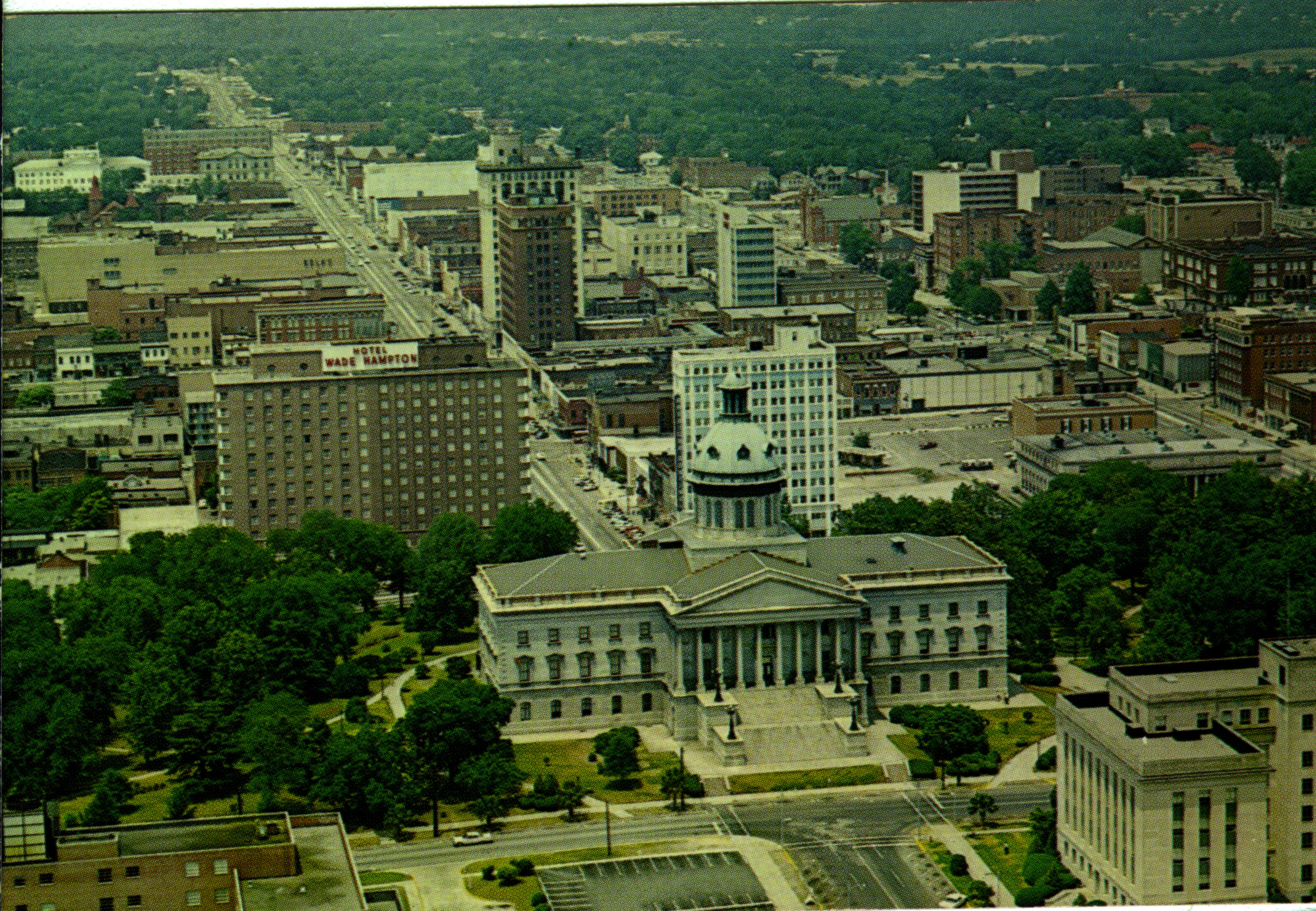

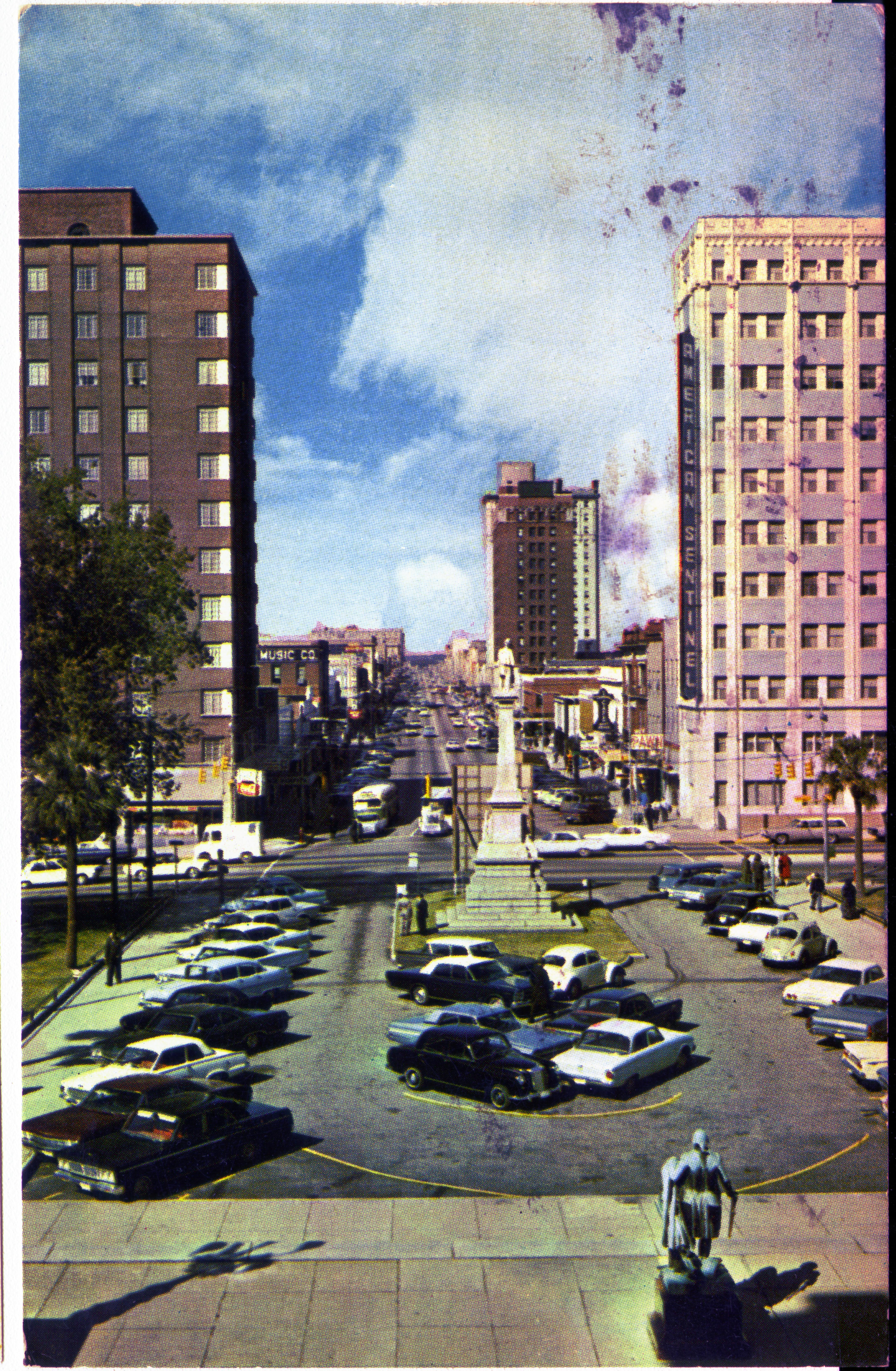
COLUMBIA, SOUTH CAROLINA
Looking down Main Street from the Capitol Steps. Points of interest: Foreground, bronze statue of George Washington; Center Monument in memory of soldiers of the Confederacy; left Wade Hampton Hotel; right American Sentinel

The Wade Hampton Hotel was a fixture across from The Capitol when I was growing up, although I don't believe I ever set foot inside. The place had a "I was built in the 1940s" look which is enhanced by the marquee shown in one picture identifying the place rather antiquely as Hotel Wade Hampton rather than The Wade Hampton Hotel.
There was a restaurant inside the hotel called Maxim's which I have an ad for somewhere that I have not got around to scanning. It was to the effect that 5 Million Frenchmen are going to the wrong Maxim's!.
By the 70s, the hotel was on a downward slide as national chains built newer properties in more convienient locations as downtown lost its pull and the Interstates came through. By the time I started college at USC in 1980, the hotel had gone under and was being leased by the University as dormitory space much in much the same fashion as Benedict's ill-fated leasing of the old Quality Inn. I don't know if similar safety considerations in the aging building brought that situation to an end or if USC just built sufficient new space (I think Bates came online about that time), but at any rate the arrangement was terminated, and nothing took its place, so the building was finally demolished in the early 80s. I think it was an early morning implosion, which I missed since I am not a morning person, but I could be wrong.
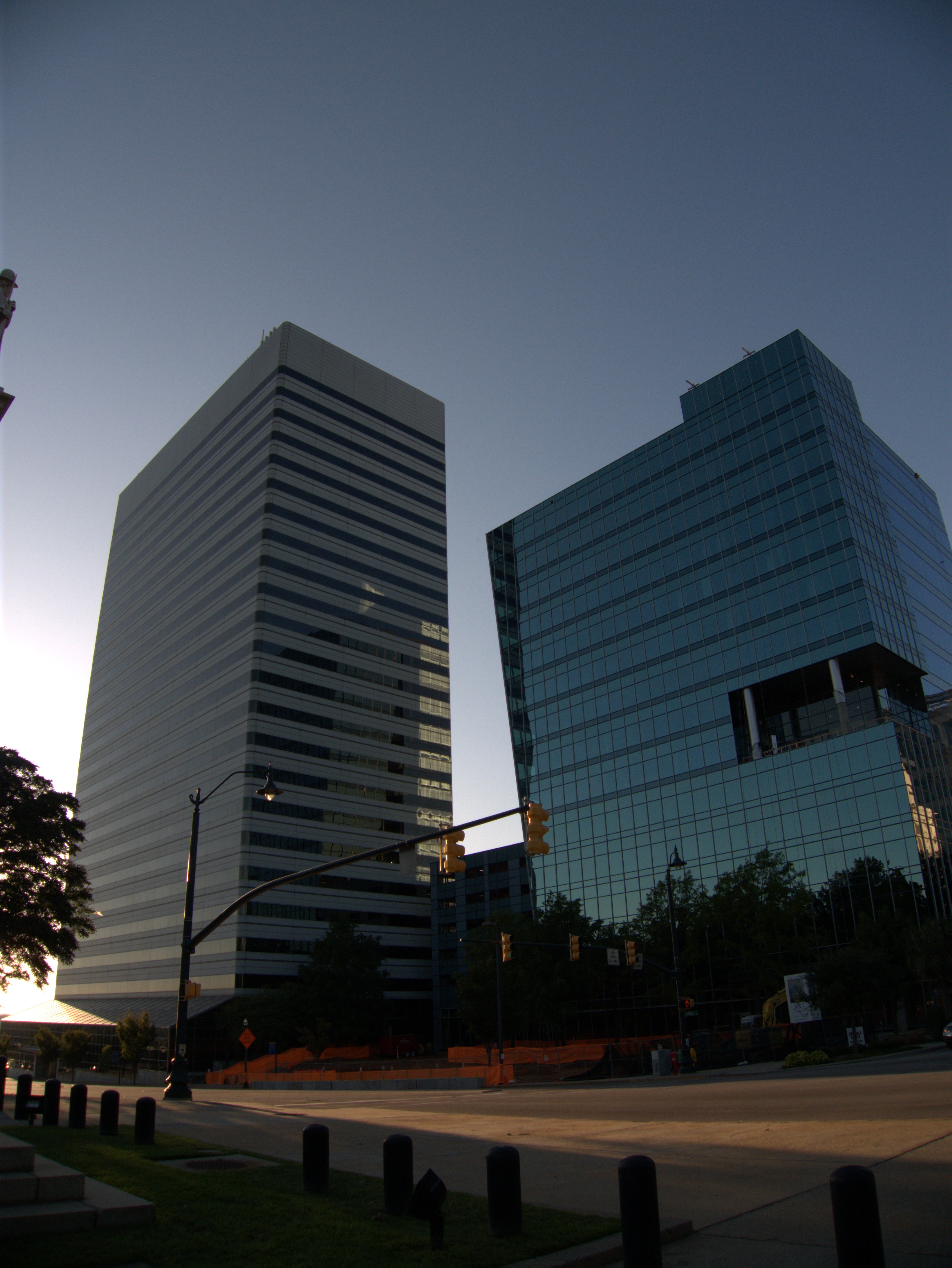
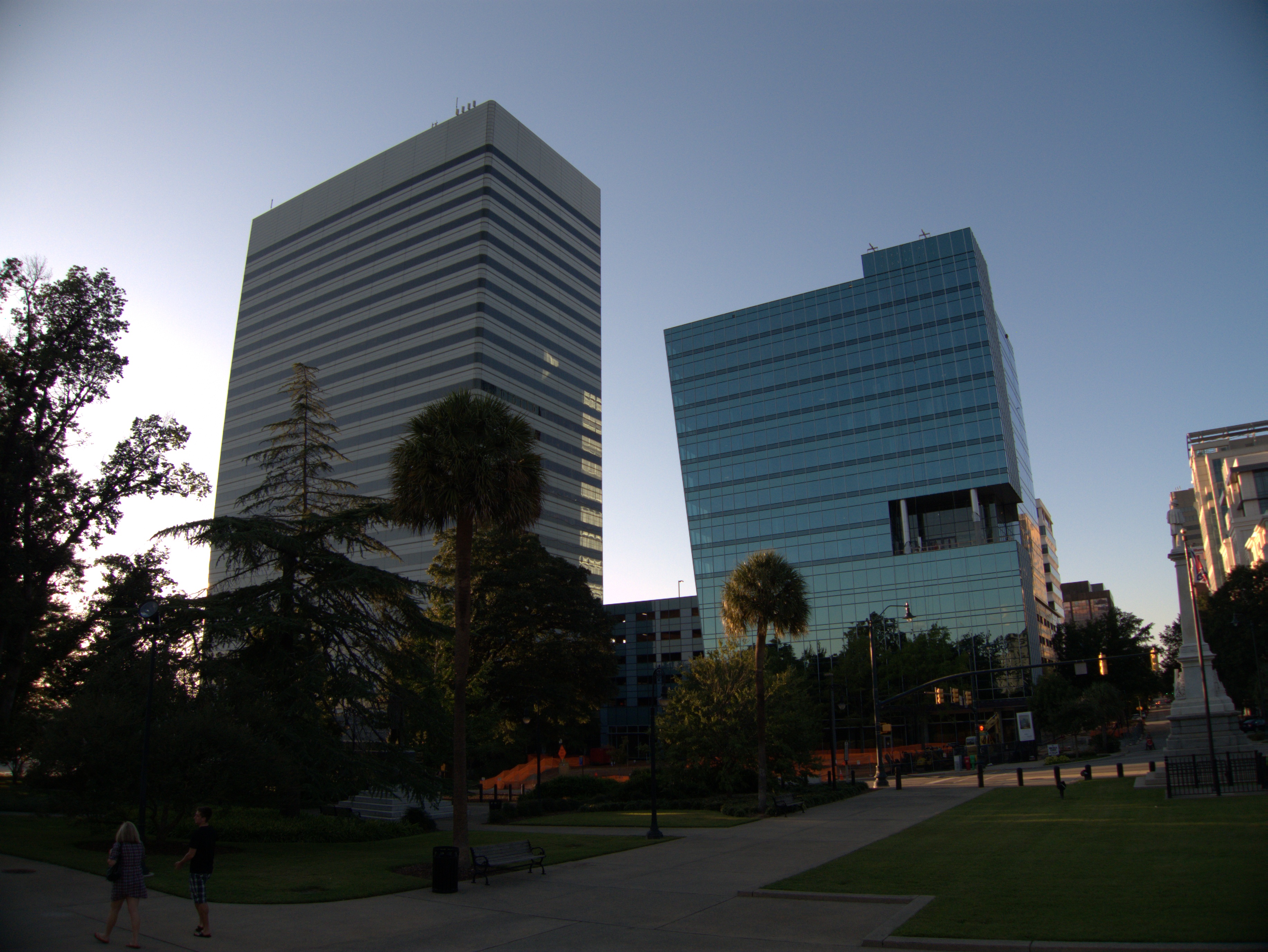
The hotel's place on the block was taken by the AT&T building (or whatever it is called now) and a new building just going up. (Was there something else there in between WH and the crooked looking glass building?)
The views from the Capitol steps are interesting. I had totally forgotten that there was parking in front of the Capitol. Also, the Colonial Life / American Sentinel / WOLO building is really hanging in there isn't it?
Finally google turns up this. This is largely a nostalgia site but lest the retro-spectacle lenses get too rosy, there's a lot to be said for the present as well.
UPDATE 8 Sept 2010: Added Wade Hampton matchbook scan.
UPDATE 25 October 2021: Add full street address to post title. Update tags. Change expired link to wayback machine link. Add map icon.
![]()